Atayurdu geodata
Atayurdu (Hatay) is a populated place; located in Turkey in Europe/Istanbul (GMT+3) time zone. With population of 602 people, there are 1251 cities with bigger population in this country. Compared to other cities in Turkey, 98.6% of cities are located further ↑North; 53.2% of cities are located further ←West and 70.2% of cities have higher elevation than Atayurdu. Note1


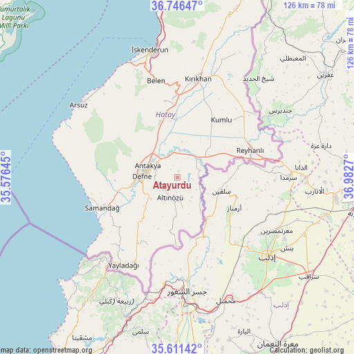
Atayurdu GPS coordinates[2]
36° 10' 51.6" North, 36° 16' 46.452" East
| Map corner | latitude | longitude |
|---|---|---|
| Upper-left | 36.74647°, | 35.57645° |
| Center: | 36.181°, | 36.27957° |
| Lower-right: | 35.61142°, | 36.9827° |
| Map W x H: | 126.2×126.2 km | = 78.4×78.4mi |
| max Lat: | 42.02683° ⇑98.6% North |
| Atayurdu: | 36.181° |
| min Lat: | ⇓1.4% South 35.9025° |
| min Long | Atayurdu | max Long |
| 25.90902° | 36.27957° | 44.60099° |
| W 53.2%⇐ | ⇒46.8% E |
Elevation
Elevation of Atayurdu is 296 m = 971 ft, and this is 421.4 m = 1383 ft below average elevation for this country.
| Max E: |
2682 m = 8799 ft | 70.2% |
| Avg. | 717.4 m = 2354 ft | |
| Atayurdu | 296 m = 971 ft | |
Min E: |
0 m = 0 ft | 29.8% |
See also: Turkey elevation on elevation.city.
Geographical zone
Atayurdu is located in North temperate zone (between Tropic of Cancer and the Arctic Circle). Distance of this Northern Tropic circle is 1417 km =880.5 mi to South.| Distance of | km | miles | from Atayurdu |
|---|---|---|---|
| North Pole | 5984.1 | 3718.3 | to North |
| Arctic Circle | 3378.2 | 2099.1 | to North |
| Tropic Cancer | 1417 | 880.5 | to South |
| Equator | 4023 | 2499.8 | to South |


Nearby cities:
15 places around Atayurdu: (largest is in red/bold)
• Altınözü
8.2 km =5.1 mi,  202°
202°
• Antakya
11.3 km =7 mi,  284°
284°
• Açıkdere
4.6 km =2.9 mi,  337°
337°
• Aşağıokçular
12.5 km =7.8 mi,  268°
268°
• Babatorun
11.6 km =7.2 mi,  175°
175°
• Boynuyoğun
5.8 km =3.6 mi,  102°
102°
• Büyük Dalyan
13.5 km =8.4 mi,  332°
332°
• Dursunlu
11 km =6.8 mi,  262°
262°
• Gümüşgöze
13.7 km =8.5 mi,  254°
254°
• Harbiye
14 km =8.7 mi, 249°
• Hıdırbey
13.9 km =8.6 mi, 282°
• Kastal
8.2 km =5.1 mi, 334°
• Mansurlu
6.2 km =3.9 mi,  315°
315°
• Tepehan
5.2 km =3.2 mi,  241°
241°
• Yeşilova
10 km =6.2 mi,  346°
346°
Sources, notices
• [Note1] Compared only with cities in Turkey existing in our database
• [Src1] Map data: © OpenStreetMap contributors (CC-BY-SA)
• [Src2] Other city data from geonames.org with taken over terms of usage.
• [Src3] Geographical zone / Annual Mean Temperature by Robert A. Rohde @ Wikipedia
