Hacıpaşa geodata
Hacıpaşa (Hatay) is a populated place; located in Turkey in Europe/Istanbul (GMT+3) time zone. With population of 3,274 people, there are 839 cities with bigger population in this country. Compared to other cities in Turkey, 99.7% of cities are located further ↑North; 53.9% of cities are located further ←West and 80.5% of cities have higher elevation than Hacıpaşa. Note1


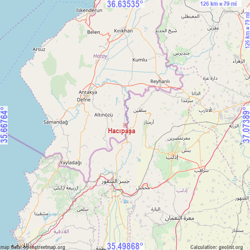
Hacıpaşa GPS coordinates[2]
36° 4' 8.652" North, 36° 22' 14.736" East
| Map corner | latitude | longitude |
|---|---|---|
| Upper-left | 36.63535°, | 35.66764° |
| Center: | 36.06907°, | 36.37076° |
| Lower-right: | 35.49868°, | 37.07389° |
| Map W x H: | 126.4×126.4 km | = 78.5×78.5mi |
| max Lat: | 42.02683° ⇑99.7% North |
| Hacıpaşa: | 36.06907° |
| min Lat: | ⇓0.3% South 35.9025° |
| min Long | Hacıpaşa | max Long |
| 25.90902° | 36.37076° | 44.60099° |
| W 53.9%⇐ | ⇒46.1% E |
Elevation
Elevation of Hacıpaşa is 112 m = 367 ft, and this is 605.4 m = 1986 ft below average elevation for this country.
| Max E: |
2682 m = 8799 ft | 80.5% |
| Avg. | 717.4 m = 2354 ft | |
| Hacıpaşa | 112 m = 367 ft | |
Min E: |
0 m = 0 ft | 19.5% |
See also: Turkey elevation on elevation.city.
Geographical zone
Hacıpaşa is located in North temperate zone (between Tropic of Cancer and the Arctic Circle). Distance of this Northern Tropic circle is 1404.6 km =872.8 mi to South.| Distance of | km | miles | from Hacıpaşa |
|---|---|---|---|
| North Pole | 5996.6 | 3726.1 | to North |
| Arctic Circle | 3390.7 | 2106.9 | to North |
| Tropic Cancer | 1404.6 | 872.8 | to South |
| Equator | 4010.5 | 2492 | to South |


Nearby cities:
15 places around Hacıpaşa: (largest is in red/bold)
• Altınözü
12.3 km =7.6 mi,  293°
293°
• Atayurdu
14.9 km =9.3 mi,  326°
326°
• Avuttepe
8.7 km =5.4 mi,  256°
256°
• Açıkdere
19.4 km =12.1 mi, 329°
• Babatorun
7.3 km =4.5 mi,  277°
277°
• Boynuyoğun
11.4 km =7.1 mi,  347°
347°
• Dursunlu
22 km =13.7 mi,  299°
299°
• Gümüşgöze
23.1 km =14.4 mi, 292°
• Harbiye
22.7 km =14.1 mi, 289°
• Kastal
23 km =14.3 mi, 329°
• Kışlak
22.3 km =13.9 mi,  239°
239°
• Mansurlu
21 km =13 mi,  323°
323°
• Tepehan
16.2 km =10.1 mi,  307°
307°
• Yiğityolu
12.9 km =8 mi,  230°
230°
• Şenköy
20.5 km =12.7 mi, 263°
Sources, notices
• [Note1] Compared only with cities in Turkey existing in our database
• [Src1] Map data: © OpenStreetMap contributors (CC-BY-SA)
• [Src2] Other city data from geonames.org with taken over terms of usage.
• [Src3] Geographical zone / Annual Mean Temperature by Robert A. Rohde @ Wikipedia
