Zigopor geodata
Zigopor (Artvin) is a seat of a second-order administrative division; located in Turkey in Europe/Istanbul (GMT+3) time zone. In our database, there are 1323 cities with bigger population. Compared to other cities in Turkey, 87.7% of cities are located further ↓South; 86.2% of cities are located further ←West and 68.8% of cities have lower elevation than Zigopor. Note1


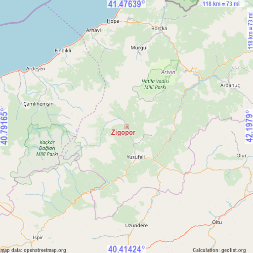
Zigopor GPS coordinates[2]
40° 56' 50.82" North, 41° 29' 41.172" East
| Map corner | latitude | longitude |
|---|---|---|
| Upper-left | 41.47639°, | 40.79165° |
| Center: | 40.94745°, | 41.49477° |
| Lower-right: | 40.41424°, | 42.1979° |
| Map W x H: | 118.1×118.1 km | = 73.4×73.4mi |
| max Lat: | 42.02683° ⇑12.3% North |
| Zigopor: | 40.94745° |
| min Lat: | ⇓87.7% South 35.9025° |
| min Long | Zigopor | max Long |
| 25.90902° | 41.49477° | 44.60099° |
| W 86.2%⇐ | ⇒13.8% E |
Elevation
Elevation of Zigopor is 1012 m = 3320 ft, and this is 294.6 m = 967 ft above average elevation for this country.
| Max E: |
2682 m = 8799 ft | 31.2% |
| Zigopor | 1012 m 3320 ft | |
| Avg. | 717.4 m = 2354 ft | |
Min E: |
0 m = 0 ft | 68.8% |
See also: Turkey elevation on elevation.city.
Geographical zone
Zigopor is located in North temperate zone (between Tropic of Cancer and the Arctic Circle). Distance of this Northern Tropic circle is 1947 km =1209.8 mi to South.| Distance of | km | miles | from Zigopor |
|---|---|---|---|
| North Pole | 5454.1 | 3389 | to North |
| Arctic Circle | 2848.2 | 1769.8 | to North |
| Tropic Cancer | 1947 | 1209.8 | to South |
| Equator | 4552.9 | 2829 | to South |


Nearby cities:
15 places around Zigopor: (largest is in red/bold)
• Arhavi
47.6 km =29.6 mi,  340°
340°
• Artvin
37.8 km =23.5 mi,  46°
46°
• Borçka
47.8 km =29.7 mi,  17°
17°
• Demirkent
21.1 km =13.1 mi,  111°
111°
• Fındıklı
46.5 km =28.9 mi,  320°
320°
• Kılıçkaya
27 km =16.8 mi,  183°
183°
• Murgul
37.3 km =23.2 mi,  7°
7°
• Ortacalar
38.1 km =23.7 mi,  345°
345°
• Seyitler
39.7 km =24.7 mi, 46°
• Uzundere
46.3 km =28.8 mi, 175°
• Yusufeli
14.6 km =9.1 mi,  165°
165°
• Zeytinlik
35.4 km =22 mi,  59°
59°
• Çamlıhemşin
43 km =26.7 mi,  285°
285°
• Çamlıkaya
44.8 km =27.8 mi,  220°
220°
• Öğdem
12.3 km =7.6 mi, 105°
Sources, notices
• [Note1] Compared only with cities in Turkey existing in our database
• [Src1] Map data: © OpenStreetMap contributors (CC-BY-SA)
• [Src2] Other city data from geonames.org with taken over terms of usage.
• [Src3] Geographical zone / Annual Mean Temperature by Robert A. Rohde @ Wikipedia
