Uzundere geodata
Uzundere (Erzurum) is a seat of a second-order administrative division; located in Turkey in Europe/Istanbul (GMT+3) time zone. With population of 5,555 people, there are 680 cities with bigger population in this country. Compared to other cities in Turkey, 78.1% of cities are located further ↓South; 86.6% of cities are located further ←West and 77.6% of cities have lower elevation than Uzundere. Note1


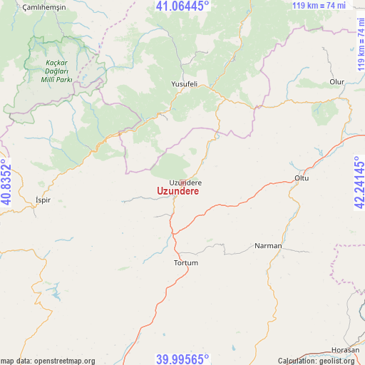
Uzundere GPS coordinates[2]
40° 31' 55.848" North, 41° 32' 17.952" East
| Map corner | latitude | longitude |
|---|---|---|
| Upper-left | 41.06445°, | 40.8352° |
| Center: | 40.53218°, | 41.53832° |
| Lower-right: | 39.99565°, | 42.24145° |
| Map W x H: | 118.8×118.8 km | = 73.8×73.8mi |
| max Lat: | 42.02683° ⇑21.9% North |
| Uzundere: | 40.53218° |
| min Lat: | ⇓78.1% South 35.9025° |
| min Long | Uzundere | max Long |
| 25.90902° | 41.53832° | 44.60099° |
| W 86.6%⇐ | ⇒13.4% E |
Elevation
Elevation of Uzundere is 1148 m = 3766 ft, and this is 430.6 m = 1413 ft above average elevation for this country.
| Max E: |
2682 m = 8799 ft | 22.4% |
| Uzundere | 1148 m 3766 ft | |
| Avg. | 717.4 m = 2354 ft | |
Min E: |
0 m = 0 ft | 77.6% |
See also: Turkey elevation on elevation.city.
Geographical zone
Uzundere is located in North temperate zone (between Tropic of Cancer and the Arctic Circle). Distance of this Northern Tropic circle is 1900.8 km =1181.1 mi to South.| Distance of | km | miles | from Uzundere |
|---|---|---|---|
| North Pole | 5500.3 | 3417.7 | to North |
| Arctic Circle | 2894.4 | 1798.5 | to North |
| Tropic Cancer | 1900.8 | 1181.1 | to South |
| Equator | 4506.8 | 2800.4 | to South |


Nearby cities:
15 places around Uzundere: (largest is in red/bold)
• Demirkent
41.8 km =26 mi,  22°
22°
• Dumlu
54.9 km =34.1 mi,  196°
196°
• Kılıçkaya
19.9 km =12.4 mi,  344°
344°
• Kırık
57.2 km =35.5 mi,  246°
246°
• Kışlaköy
47.1 km =29.3 mi,  119°
119°
• Narman
34.4 km =21.4 mi,  127°
127°
• Oltu
37.9 km =23.5 mi,  88°
88°
• Ovacık
58.8 km =36.5 mi,  231°
231°
• Tortum
27 km =16.8 mi,  179°
179°
• Yusufeli
32 km =19.9 mi,  359°
359°
• Zigopor
46.3 km =28.8 mi, 355°
• Çamlıkaya
34.7 km =21.6 mi,  290°
290°
• Öğdem
43.6 km =27.1 mi,  10°
10°
• İspir
46.4 km =28.8 mi,  262°
262°
• Şenyurt
15 km =9.3 mi,  218°
218°
Sources, notices
• [Note1] Compared only with cities in Turkey existing in our database
• [Src1] Map data: © OpenStreetMap contributors (CC-BY-SA)
• [Src2] Other city data from geonames.org with taken over terms of usage.
• [Src3] Geographical zone / Annual Mean Temperature by Robert A. Rohde @ Wikipedia
