Sarıbuğday geodata
Sarıbuğday (Amasya) is a seat of a third-order administrative division; located in Turkey in Europe/Istanbul (GMT+3) time zone. In our database, there are 1323 cities with bigger population. Compared to other cities in Turkey, 82.3% of cities are located further ↓South; 52.4% of cities are located further →East and 57.6% of cities have higher elevation than Sarıbuğday. Note1


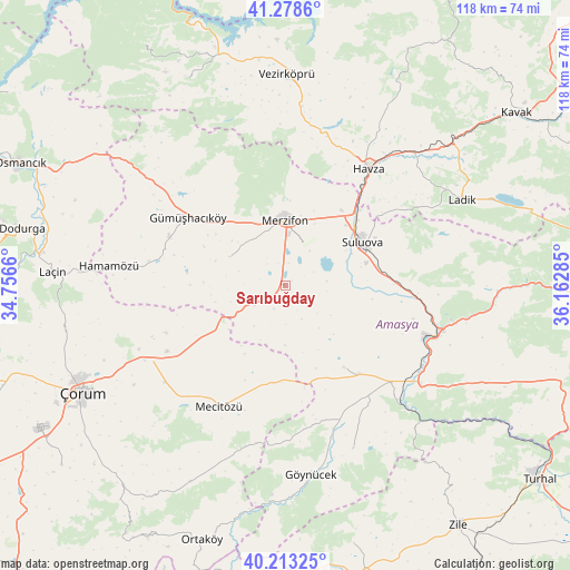
Sarıbuğday GPS coordinates[2]
40° 44' 53.016" North, 35° 27' 34.992" East
| Map corner | latitude | longitude |
|---|---|---|
| Upper-left | 41.2786°, | 34.7566° |
| Center: | 40.74806°, | 35.45972° |
| Lower-right: | 40.21325°, | 36.16285° |
| Map W x H: | 118.5×118.5 km | = 73.6×73.6mi |
| max Lat: | 42.02683° ⇑17.7% North |
| Sarıbuğday: | 40.74806° |
| min Lat: | ⇓82.3% South 35.9025° |
| min Long | Sarıbuğday | max Long |
| 25.90902° | 35.45972° | 44.60099° |
| W 47.6%⇐ | ⇒52.4% E |
Elevation
Elevation of Sarıbuğday is 547 m = 1795 ft, and this is 170.4 m = 559 ft below average elevation for this country.
| Max E: |
2682 m = 8799 ft | 57.6% |
| Avg. | 717.4 m = 2354 ft | |
| Sarıbuğday | 547 m = 1795 ft | |
Min E: |
0 m = 0 ft | 42.4% |
See also: Turkey elevation on elevation.city.
Geographical zone
Sarıbuğday is located in North temperate zone (between Tropic of Cancer and the Arctic Circle). Distance of this Northern Tropic circle is 1924.8 km =1196 mi to South.| Distance of | km | miles | from Sarıbuğday |
|---|---|---|---|
| North Pole | 5476.3 | 3402.8 | to North |
| Arctic Circle | 2870.4 | 1783.6 | to North |
| Tropic Cancer | 1924.8 | 1196 | to South |
| Equator | 4530.8 | 2815.3 | to South |


Nearby cities:
15 places around Sarıbuğday: (largest is in red/bold)
• Alıcık
13.1 km =8.1 mi,  297°
297°
• Amasya
33.2 km =20.6 mi,  108°
108°
• Dedeköy
35.1 km =21.8 mi,  269°
269°
• Doğantepe
20.7 km =12.9 mi,  143°
143°
• Gediksaray
36.5 km =22.7 mi,  157°
157°
• Göynücek
39.2 km =24.4 mi,  171°
171°
• Gümüş
26.3 km =16.3 mi,  292°
292°
• Gümüşhacıköy
24.9 km =15.5 mi, 303°
• Hamamözü
36.8 km =22.9 mi,  276°
276°
• Havza
30 km =18.6 mi,  34°
34°
• Köprübaşı
33.6 km =20.9 mi,  8°
8°
• Mecitözü
28.9 km =18 mi,  208°
208°
• Merzifon
13.9 km =8.6 mi,  1°
1°
• Saraycık
36.9 km =22.9 mi,  307°
307°
• Suluova
18.3 km =11.4 mi,  59°
59°
Sources, notices
• [Note1] Compared only with cities in Turkey existing in our database
• [Src1] Map data: © OpenStreetMap contributors (CC-BY-SA)
• [Src2] Other city data from geonames.org with taken over terms of usage.
• [Src3] Geographical zone / Annual Mean Temperature by Robert A. Rohde @ Wikipedia
