İğneada geodata
İğneada (Kırklareli) is a seat of a third-order administrative division; located in Turkey in Europe/Istanbul (GMT+3) time zone. In our database, there are 1323 cities with bigger population. Compared to other cities in Turkey, 99.4% of cities are located further ↓South; 90.3% of cities are located further →East and 92.9% of cities have higher elevation than İğneada. Note1


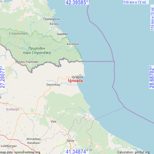
İğneada GPS coordinates[2]
41° 52' 27.984" North, 27° 59' 2.004" East
| Map corner | latitude | longitude |
|---|---|---|
| Upper-left | 42.39585°, | 27.28077° |
| Center: | 41.87444°, | 27.98389° |
| Lower-right: | 41.34874°, | 28.68702° |
| Map W x H: | 116.4×116.4 km | = 72.3×72.3mi |
| max Lat: | 42.02683° ⇑0.6% North |
| İğneada: | 41.87444° |
| min Lat: | ⇓99.4% South 35.9025° |
| min Long | İğneada | max Long |
| 25.90902° | 27.98389° | 44.60099° |
| W 9.7%⇐ | ⇒90.3% E |
Elevation
Elevation of İğneada is 25 m = 82 ft, and this is 692.4 m = 2272 ft below average elevation for this country.
| Max E: |
2682 m = 8799 ft | 92.9% |
| Avg. | 717.4 m = 2354 ft | |
| İğneada | 25 m = 82 ft | |
Min E: |
0 m = 0 ft | 7.1% |
See also: Turkey elevation on elevation.city.
Geographical zone
İğneada is located in North temperate zone (between Tropic of Cancer and the Arctic Circle). Distance of this Northern Tropic circle is 2050.1 km =1273.9 mi to South.| Distance of | km | miles | from İğneada |
|---|---|---|---|
| North Pole | 5351.1 | 3325 | to North |
| Arctic Circle | 2745.2 | 1705.8 | to North |
| Tropic Cancer | 2050.1 | 1273.9 | to South |
| Equator | 4656 | 2893.1 | to South |


Nearby cities:
15 places around İğneada: (largest is in red/bold)
• Beyazköy
63 km =39.1 mi,  201°
201°
• Büyükçavuşlu
70.8 km =44 mi,  174°
174°
• Dereköy
51.1 km =31.8 mi,  276°
276°
• Kapaklı
60.6 km =37.7 mi,  180°
180°
• Karacaköy
61.9 km =38.5 mi,  147°
147°
• Kofçaz
68.8 km =42.8 mi, 276°
• Kırklareli
64.8 km =40.3 mi,  256°
256°
• Pınarhisar
47.5 km =29.5 mi,  234°
234°
• Salmydessus
28.2 km =17.5 mi,  160°
160°
• Saray
48.1 km =29.9 mi,  186°
186°
• Sergen
29.6 km =18.4 mi, 230°
• Velimeşe
69.6 km =43.2 mi, 187°
• Vize
38.1 km =23.7 mi,  208°
208°
• Çerkezköy
65.4 km =40.6 mi, 178°
• Üsküp
50.4 km =31.3 mi,  252°
252°
Sources, notices
• [Note1] Compared only with cities in Turkey existing in our database
• [Src1] Map data: © OpenStreetMap contributors (CC-BY-SA)
• [Src2] Other city data from geonames.org with taken over terms of usage.
• [Src3] Geographical zone / Annual Mean Temperature by Robert A. Rohde @ Wikipedia
