Karacaköy geodata
Karacaköy (Istanbul) is a populated place; located in Turkey in Europe/Istanbul (GMT+3) time zone. With population of 3,105 people, there are 854 cities with bigger population in this country. Compared to other cities in Turkey, 96.4% of cities are located further ↓South; 87.7% of cities are located further →East and 93.4% of cities have higher elevation than Karacaköy. Note1


Karacaköy GPS coordinates[2]
41° 24' 12.168" North, 28° 22' 49.98" East
| Map corner | latitude | longitude |
|---|---|---|
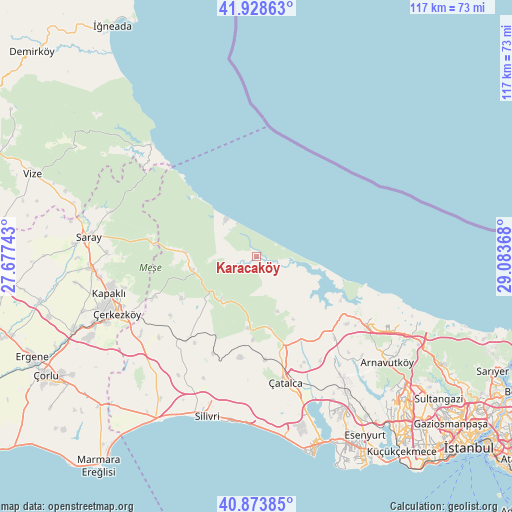
| Upper-left | 41.92863°, | 27.67743° |
| Center: | 41.40338°, | 28.38055° |
| Lower-right: | 40.87385°, | 29.08368° |
| Map W x H: | 117.3×117.3 km | = 72.9×72.9mi |
| max Lat: | 42.02683° ⇑3.6% North |
| Karacaköy: | 41.40338° |
| min Lat: | ⇓96.4% South 35.9025° |
| min Long | Karacaköy | max Long |
| 25.90902° | 28.38055° | 44.60099° |
| W 12.3%⇐ | ⇒87.7% E |
Elevation
Elevation of Karacaköy is 23 m = 75 ft, and this is 694.4 m = 2278 ft below average elevation for this country.
| Max E: |
2682 m = 8799 ft | 93.4% |
| Avg. | 717.4 m = 2354 ft | |
| Karacaköy | 23 m = 75 ft | |
Min E: |
0 m = 0 ft | 6.6% |
See also: Turkey elevation on elevation.city.
Geographical zone
Karacaköy is located in North temperate zone (between Tropic of Cancer and the Arctic Circle). Distance of this Northern Tropic circle is 1997.7 km =1241.3 mi to South.| Distance of | km | miles | from Karacaköy |
|---|---|---|---|
| North Pole | 5403.4 | 3357.5 | to North |
| Arctic Circle | 2797.5 | 1738.3 | to North |
| Tropic Cancer | 1997.7 | 1241.3 | to South |
| Equator | 4603.6 | 2860.5 | to South |


Nearby cities:
15 places around Karacaköy: (largest is in red/bold)
• Arnavutköy
38.7 km =24 mi,  129°
129°
• Boyalık
26.1 km =16.2 mi, 126°
• Büyük Sinekli
24.2 km =15 mi,  215°
215°
• Büyükçavuşlu
32.1 km =19.9 mi,  235°
235°
• Durusu
27.1 km =16.8 mi,  114°
114°
• Kapaklı
34.4 km =21.4 mi,  256°
256°
• Kavaklı
34.8 km =21.6 mi,  186°
186°
• Muratbey
35.4 km =22 mi,  164°
164°
• Ortaköy
33.6 km =20.9 mi,  180°
180°
• Salmydessus
35.1 km =21.8 mi,  317°
317°
• Saray
38.5 km =23.9 mi,  276°
276°
• Silivri
38.3 km =23.8 mi,  197°
197°
• Sinekli
25.1 km =15.6 mi, 219°
• Çatalca
29.7 km =18.5 mi,  166°
166°
• Çerkezköy
34.4 km =21.4 mi,  247°
247°
Sources, notices
• [Note1] Compared only with cities in Turkey existing in our database
• [Src1] Map data: © OpenStreetMap contributors (CC-BY-SA)
• [Src2] Other city data from geonames.org with taken over terms of usage.
• [Src3] Geographical zone / Annual Mean Temperature by Robert A. Rohde @ Wikipedia
