Sergen geodata
Sergen (Kırklareli) is a seat of a third-order administrative division; located in Turkey in Europe/Istanbul (GMT+3) time zone. In our database, there are 1323 cities with bigger population. Compared to other cities in Turkey, 98.7% of cities are located further ↓South; 92.1% of cities are located further →East and 64.5% of cities have higher elevation than Sergen. Note1


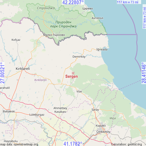
Sergen GPS coordinates[2]
41° 42' 19.008" North, 27° 42' 29.988" East
| Map corner | latitude | longitude |
|---|---|---|
| Upper-left | 42.22807°, | 27.00521° |
| Center: | 41.70528°, | 27.70833° |
| Lower-right: | 41.1782°, | 28.41146° |
| Map W x H: | 116.7×116.7 km | = 72.5×72.5mi |
| max Lat: | 42.02683° ⇑1.3% North |
| Sergen: | 41.70528° |
| min Lat: | ⇓98.7% South 35.9025° |
| min Long | Sergen | max Long |
| 25.90902° | 27.70833° | 44.60099° |
| W 7.9%⇐ | ⇒92.1% E |
Elevation
Elevation of Sergen is 425 m = 1394 ft, and this is 292.4 m = 959 ft below average elevation for this country.
| Max E: |
2682 m = 8799 ft | 64.5% |
| Avg. | 717.4 m = 2354 ft | |
| Sergen | 425 m = 1394 ft | |
Min E: |
0 m = 0 ft | 35.5% |
See also: Turkey elevation on elevation.city.
Geographical zone
Sergen is located in North temperate zone (between Tropic of Cancer and the Arctic Circle). Distance of this Northern Tropic circle is 2031.3 km =1262.2 mi to South.| Distance of | km | miles | from Sergen |
|---|---|---|---|
| North Pole | 5369.9 | 3336.7 | to North |
| Arctic Circle | 2764 | 1717.5 | to North |
| Tropic Cancer | 2031.3 | 1262.2 | to South |
| Equator | 4637.2 | 2881.4 | to South |


Nearby cities:
15 places around Sergen: (largest is in red/bold)
• Beyazköy
39.7 km =24.7 mi,  180°
180°
• Büyükkarıştıran
47 km =29.2 mi,  196°
196°
• Dereköy
37.5 km =23.3 mi,  311°
311°
• Kapaklı
47.6 km =29.6 mi,  151°
151°
• Kofçaz
52.8 km =32.8 mi,  300°
300°
• Kırklareli
40.2 km =25 mi,  274°
274°
• Lüleburgaz
44.4 km =27.6 mi,  220°
220°
• Pınarhisar
18.1 km =11.2 mi,  240°
240°
• Salmydessus
33 km =20.5 mi,  103°
103°
• Saray
34 km =21.1 mi, 148°
• Velimeşe
52.2 km =32.4 mi,  164°
164°
• Vize
15.5 km =9.6 mi, 162°
• Çerkezköy
52.5 km =32.6 mi, 152°
• Üsküp
25.4 km =15.8 mi,  277°
277°
• İğneada
29.6 km =18.4 mi,  50°
50°
Sources, notices
• [Note1] Compared only with cities in Turkey existing in our database
• [Src1] Map data: © OpenStreetMap contributors (CC-BY-SA)
• [Src2] Other city data from geonames.org with taken over terms of usage.
• [Src3] Geographical zone / Annual Mean Temperature by Robert A. Rohde @ Wikipedia
