Esenyurt geodata
Esenyurt (Istanbul) is a populated place; located in Turkey in Europe/Istanbul (GMT+3) time zone. With population of 211,330 people, there are 46 cities with bigger population in this country. Compared to other cities in Turkey, 90.1% of cities are located further ↓South; 85.9% of cities are located further →East and 82% of cities have higher elevation than Esenyurt. Note1


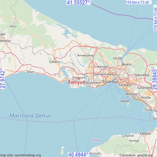
Esenyurt GPS coordinates[2]
41° 1' 37.092" North, 28° 40' 38.352" East
| Map corner | latitude | longitude |
|---|---|---|
| Upper-left | 41.55527°, | 27.9742° |
| Center: | 41.02697°, | 28.67732° |
| Lower-right: | 40.4944°, | 29.38045° |
| Map W x H: | 118×118 km | = 73.3×73.3mi |
| max Lat: | 42.02683° ⇑9.9% North |
| Esenyurt: | 41.02697° |
| min Lat: | ⇓90.1% South 35.9025° |
| min Long | Esenyurt | max Long |
| 25.90902° | 28.67732° | 44.60099° |
| W 14.1%⇐ | ⇒85.9% E |
Elevation
Elevation of Esenyurt is 97 m = 318 ft, and this is 620.4 m = 2035 ft below average elevation for this country.
| Max E: |
2682 m = 8799 ft | 82% |
| Avg. | 717.4 m = 2354 ft | |
| Esenyurt | 97 m = 318 ft | |
Min E: |
0 m = 0 ft | 18% |
See also: Esenyurt elevation on elevation.city.
Geographical zone
Esenyurt is located in North temperate zone (between Tropic of Cancer and the Arctic Circle). Distance of this Northern Tropic circle is 1955.9 km =1215.3 mi to South.| Distance of | km | miles | from Esenyurt |
|---|---|---|---|
| North Pole | 5445.3 | 3383.6 | to North |
| Arctic Circle | 2839.4 | 1764.3 | to North |
| Tropic Cancer | 1955.9 | 1215.3 | to South |
| Equator | 4561.8 | 2834.6 | to South |


Nearby cities:
15 places around Esenyurt: (largest is in red/bold)
• Bahçelievler
15.6 km =9.7 mi,  100°
100°
• Bağcılar
15.1 km =9.4 mi,  84°
84°
• Başakşehir
12.8 km =8 mi,  54°
54°
• Beylikdüzü
5.9 km =3.7 mi,  212°
212°
• Büyükçekmece
7.8 km =4.8 mi,  264°
264°
• Chekmejeh
11.8 km =7.3 mi, 262°
• Esenler
16.8 km =10.4 mi, 83°
• Gürpınar
6.5 km =4 mi,  234°
234°
• Kumburgaz
16.5 km =10.3 mi,  267°
267°
• Mahmutbey
12.8 km =8 mi, 76°
• Merter Keresteciler
17.6 km =10.9 mi, 95°
• Mimarsinan
9.7 km =6 mi, 264°
• Muratbey
17.3 km =10.7 mi,  296°
296°
• Tepecik
10.7 km =6.6 mi, 271°
• Yakuplu
4.2 km =2.6 mi,  181°
181°
Sources, notices
• [Note1] Compared only with cities in Turkey existing in our database
• [Src1] Map data: © OpenStreetMap contributors (CC-BY-SA)
• [Src2] Other city data from geonames.org with taken over terms of usage.
• [Src3] Geographical zone / Annual Mean Temperature by Robert A. Rohde @ Wikipedia
