Büyükçekmece geodata
Büyükçekmece (Istanbul) is a seat of a second-order administrative division; located in Turkey in Europe/Istanbul (GMT+3) time zone. With population of 163,140 people, there are 58 cities with bigger population in this country. Compared to other cities in Turkey, 89.7% of cities are located further ↓South; 86.6% of cities are located further →East and 99.3% of cities have higher elevation than Büyükçekmece. Note1


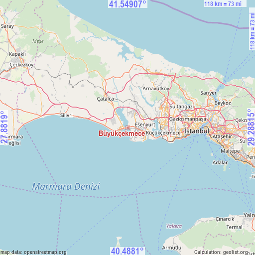
Büyükçekmece GPS coordinates[2]
41° 1' 14.592" North, 28° 35' 6.072" East
| Map corner | latitude | longitude |
|---|---|---|
| Upper-left | 41.54907°, | 27.8819° |
| Center: | 41.02072°, | 28.58502° |
| Lower-right: | 40.4881°, | 29.28815° |
| Map W x H: | 118×118 km | = 73.3×73.3mi |
| max Lat: | 42.02683° ⇑10.3% North |
| Büyükçekmece: | 41.02072° |
| min Lat: | ⇓89.7% South 35.9025° |
| min Long | Büyükçekmece | max Long |
| 25.90902° | 28.58502° | 44.60099° |
| W 13.4%⇐ | ⇒86.6% E |
Elevation
Elevation of Büyükçekmece is 5 m = 16 ft, and this is 712.4 m = 2337 ft below average elevation for this country.
| Max E: |
2682 m = 8799 ft | 99.3% |
| Avg. | 717.4 m = 2354 ft | |
| Büyükçekmece | 5 m = 16 ft | |
Min E: |
0 m = 0 ft | 0.7% |
See also: Büyükçekmece elevation on elevation.city.
Geographical zone
Büyükçekmece is located in North temperate zone (between Tropic of Cancer and the Arctic Circle). Distance of this Northern Tropic circle is 1955.2 km =1214.9 mi to South.| Distance of | km | miles | from Büyükçekmece |
|---|---|---|---|
| North Pole | 5446 | 3384 | to North |
| Arctic Circle | 2840.1 | 1764.8 | to North |
| Tropic Cancer | 1955.2 | 1214.9 | to South |
| Equator | 4561.1 | 2834.1 | to South |


Nearby cities:
15 places around Büyükçekmece: (largest is in red/bold)
• Başakşehir
19.9 km =12.4 mi,  66°
66°
• Beylikdüzü
6.3 km =3.9 mi,  133°
133°
• Celâliye
14.4 km =8.9 mi,  283°
283°
• Chekmejeh
4 km =2.5 mi,  257°
257°
• Esenyurt
7.8 km =4.8 mi,  84°
84°
• Gürpınar
4 km =2.5 mi,  141°
141°
• Kumburgaz
8.8 km =5.5 mi,  270°
270°
• Mahmutbey
20.5 km =12.7 mi, 79°
• Mimarsinan
2 km =1.2 mi, 260°
• Muratbey
11.4 km =7.1 mi,  317°
317°
• Ortaköy
19.7 km =12.2 mi,  297°
297°
• Selimpaşa
18.7 km =11.6 mi, 281°
• Tepecik
3.1 km =1.9 mi,  287°
287°
• Yakuplu
8.4 km =5.2 mi,  114°
114°
• Çatalca
17.1 km =10.6 mi, 322°
Sources, notices
• [Note1] Compared only with cities in Turkey existing in our database
• [Src1] Map data: © OpenStreetMap contributors (CC-BY-SA)
• [Src2] Other city data from geonames.org with taken over terms of usage.
• [Src3] Geographical zone / Annual Mean Temperature by Robert A. Rohde @ Wikipedia
