Değirmendere geodata
Değirmendere (Kocaeli) is a seat of a third-order administrative division; located in Turkey in Europe/Istanbul (GMT+3) time zone. In our database, there are 1323 cities with bigger population. Compared to other cities in Turkey, 81.6% of cities are located further ↓South; 77.2% of cities are located further →East and 94.8% of cities have higher elevation than Değirmendere. Note1


Değirmendere GPS coordinates[2]
40° 43' 12" North, 29° 46' 50.988" East
| Map corner | latitude | longitude |
|---|---|---|
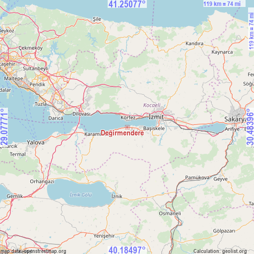
| Upper-left | 41.25077°, | 29.07771° |
| Center: | 40.72°, | 29.78083° |
| Lower-right: | 40.18497°, | 30.48396° |
| Map W x H: | 118.5×118.5 km | = 73.6×73.6mi |
| max Lat: | 42.02683° ⇑18.4% North |
| Değirmendere: | 40.72° |
| min Lat: | ⇓81.6% South 35.9025° |
| min Long | Değirmendere | max Long |
| 25.90902° | 29.78083° | 44.60099° |
| W 22.8%⇐ | ⇒77.2% E |
Elevation
Elevation of Değirmendere is 17 m = 56 ft, and this is 700.4 m = 2298 ft below average elevation for this country.
| Max E: |
2682 m = 8799 ft | 94.8% |
| Avg. | 717.4 m = 2354 ft | |
| Değirmendere | 17 m = 56 ft | |
Min E: |
0 m = 0 ft | 5.2% |
See also: Turkey elevation on elevation.city.
Geographical zone
Değirmendere is located in North temperate zone (between Tropic of Cancer and the Arctic Circle). Distance of this Northern Tropic circle is 1921.7 km =1194.1 mi to South.| Distance of | km | miles | from Değirmendere |
|---|---|---|---|
| North Pole | 5479.4 | 3404.7 | to North |
| Arctic Circle | 2873.5 | 1785.5 | to North |
| Tropic Cancer | 1921.7 | 1194.1 | to South |
| Equator | 4527.6 | 2813.3 | to South |


Nearby cities:
15 places around Değirmendere: (largest is in red/bold)
• Bahçecik
12.7 km =7.9 mi,  117°
117°
• Derince
5 km =3.1 mi,  34°
34°
• Gölcük
7.9 km =4.9 mi,  103°
103°
• Halıdere
2.5 km =1.6 mi,  259°
259°
• Hereke
15.8 km =9.8 mi,  297°
297°
• Karamürsel
14.2 km =8.8 mi, 257°
• Karşıyaka
13.9 km =8.6 mi, 102°
• Kullar
17.6 km =10.9 mi,  88°
88°
• Körfez
5.2 km =3.2 mi,  1°
1°
• Nüzhetiye
11.3 km =7 mi,  142°
142°
• Tavşancıl
18.5 km =11.5 mi,  287°
287°
• Ulaşlı
7.3 km =4.5 mi, 257°
• Yuvacık
16.1 km =10 mi, 102°
• İhsaniye
5.6 km =3.5 mi,  125°
125°
• İzmit
13.5 km =8.4 mi,  68°
68°
Sources, notices
• [Note1] Compared only with cities in Turkey existing in our database
• [Src1] Map data: © OpenStreetMap contributors (CC-BY-SA)
• [Src2] Other city data from geonames.org with taken over terms of usage.
• [Src3] Geographical zone / Annual Mean Temperature by Robert A. Rohde @ Wikipedia
