Halıdere geodata
Halıdere (Kocaeli) is a populated place; located in Turkey in Europe/Istanbul (GMT+3) time zone. With population of 3,073 people, there are 855 cities with bigger population in this country. Compared to other cities in Turkey, 81.5% of cities are located further ↓South; 77.4% of cities are located further →East and 94.8% of cities have higher elevation than Halıdere. Note1


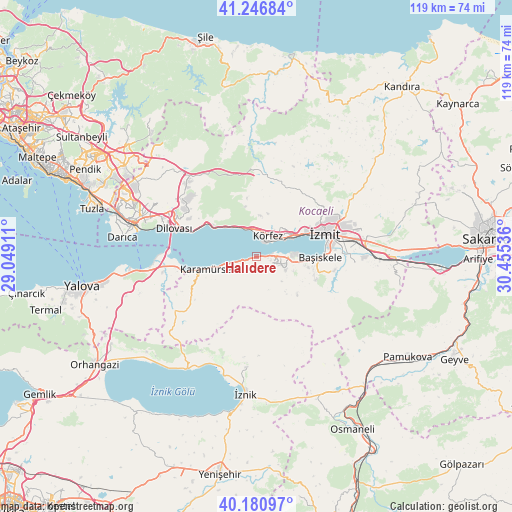
Halıdere GPS coordinates[2]
40° 42' 57.744" North, 29° 45' 8.028" East
| Map corner | latitude | longitude |
|---|---|---|
| Upper-left | 41.24684°, | 29.04911° |
| Center: | 40.71604°, | 29.75223° |
| Lower-right: | 40.18097°, | 30.45536° |
| Map W x H: | 118.5×118.5 km | = 73.6×73.6mi |
| max Lat: | 42.02683° ⇑18.5% North |
| Halıdere: | 40.71604° |
| min Lat: | ⇓81.5% South 35.9025° |
| min Long | Halıdere | max Long |
| 25.90902° | 29.75223° | 44.60099° |
| W 22.6%⇐ | ⇒77.4% E |
Elevation
Elevation of Halıdere is 17 m = 56 ft, and this is 700.4 m = 2298 ft below average elevation for this country.
| Max E: |
2682 m = 8799 ft | 94.8% |
| Avg. | 717.4 m = 2354 ft | |
| Halıdere | 17 m = 56 ft | |
Min E: |
0 m = 0 ft | 5.2% |
See also: Turkey elevation on elevation.city.
Geographical zone
Halıdere is located in North temperate zone (between Tropic of Cancer and the Arctic Circle). Distance of this Northern Tropic circle is 1921.3 km =1193.8 mi to South.| Distance of | km | miles | from Halıdere |
|---|---|---|---|
| North Pole | 5479.9 | 3405.1 | to North |
| Arctic Circle | 2874 | 1785.8 | to North |
| Tropic Cancer | 1921.3 | 1193.8 | to South |
| Equator | 4527.2 | 2813.1 | to South |


Nearby cities:
15 places around Halıdere: (largest is in red/bold)
• Bahçecik
14.7 km =9.1 mi,  111°
111°
• Dereköy
16.9 km =10.5 mi,  250°
250°
• Derince
7 km =4.3 mi,  49°
49°
• Değirmendere
2.5 km =1.6 mi,  79°
79°
• Gölcük
10.2 km =6.3 mi,  98°
98°
• Hereke
14 km =8.7 mi,  303°
303°
• Karamürsel
11.8 km =7.3 mi,  256°
256°
• Karşıyaka
16.2 km =10.1 mi, 98°
• Körfez
6.2 km =3.9 mi,  24°
24°
• Nüzhetiye
12.6 km =7.8 mi,  132°
132°
• Tavşancıl
16.4 km =10.2 mi,  291°
291°
• Ulaşlı
4.9 km =3 mi, 256°
• Yuvacık
18.4 km =11.4 mi, 99°
• İhsaniye
7.5 km =4.7 mi, 111°
• İzmit
15.9 km =9.9 mi,  69°
69°
Sources, notices
• [Note1] Compared only with cities in Turkey existing in our database
• [Src1] Map data: © OpenStreetMap contributors (CC-BY-SA)
• [Src2] Other city data from geonames.org with taken over terms of usage.
• [Src3] Geographical zone / Annual Mean Temperature by Robert A. Rohde @ Wikipedia
