Akkuş geodata
Akkuş (Ordu) is a seat of a second-order administrative division; located in Turkey in Europe/Istanbul (GMT+3) time zone. With population of 10,206 people, there are 502 cities with bigger population in this country. Compared to other cities in Turkey, 83.5% of cities are located further ↓South; 56.8% of cities are located further ←West and 84.3% of cities have lower elevation than Akkuş. Note1


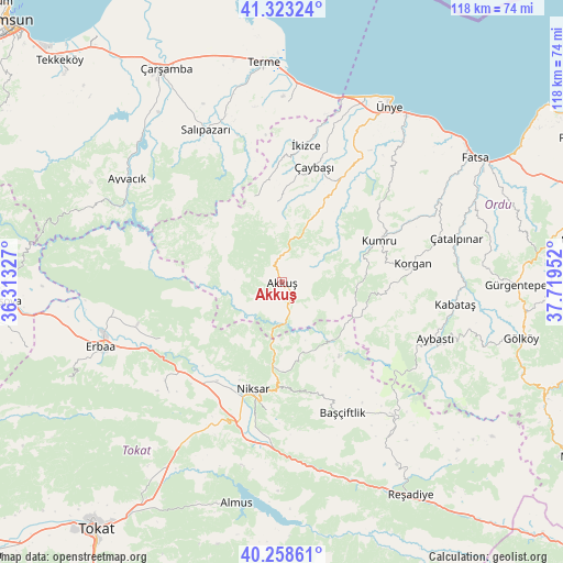
Akkuş GPS coordinates[2]
40° 47' 35.016" North, 37° 0' 59.004" East
| Map corner | latitude | longitude |
|---|---|---|
| Upper-left | 41.32324°, | 36.31327° |
| Center: | 40.79306°, | 37.01639° |
| Lower-right: | 40.25861°, | 37.71952° |
| Map W x H: | 118.4×118.4 km | = 73.6×73.6mi |
| max Lat: | 42.02683° ⇑16.5% North |
| Akkuş: | 40.79306° |
| min Lat: | ⇓83.5% South 35.9025° |
| min Long | Akkuş | max Long |
| 25.90902° | 37.01639° | 44.60099° |
| W 56.8%⇐ | ⇒43.2% E |
Elevation
Elevation of Akkuş is 1292 m = 4239 ft, and this is 574.6 m = 1885 ft above average elevation for this country.
| Max E: |
2682 m = 8799 ft | 15.7% |
| Akkuş | 1292 m 4239 ft | |
| Avg. | 717.4 m = 2354 ft | |
Min E: |
0 m = 0 ft | 84.3% |
See also: Turkey elevation on elevation.city.
Geographical zone
Akkuş is located in North temperate zone (between Tropic of Cancer and the Arctic Circle). Distance of this Northern Tropic circle is 1929.8 km =1199.1 mi to South.| Distance of | km | miles | from Akkuş |
|---|---|---|---|
| North Pole | 5471.3 | 3399.7 | to North |
| Arctic Circle | 2865.4 | 1780.5 | to North |
| Tropic Cancer | 1929.8 | 1199.1 | to South |
| Equator | 4535.8 | 2818.4 | to South |


Nearby cities:
15 places around Akkuş: (largest is in red/bold)
• Aybastı
34.3 km =21.3 mi,  110°
110°
• Başçiftlik
30.2 km =18.8 mi,  154°
154°
• Doğanyurt
27.8 km =17.3 mi,  245°
245°
• Gökçeli
33.4 km =20.8 mi,  225°
225°
• Kabataş
36.8 km =22.9 mi,  97°
97°
• Karayaka
36.3 km =22.6 mi,  261°
261°
• Korgan
28 km =17.4 mi,  82°
82°
• Kumru
22.7 km =14.1 mi,  66°
66°
• Niksar
23 km =14.3 mi,  193°
193°
• Salıpazarı
35.9 km =22.3 mi,  334°
334°
• Tekkiraz
24.6 km =15.3 mi,  29°
29°
• Çamiçi
19.5 km =12.1 mi,  183°
183°
• Çatalpınar
38 km =23.6 mi, 75°
• Çaybaşı
25.8 km =16 mi,  15°
15°
• İkizce
30 km =18.6 mi,  10°
10°
Sources, notices
• [Note1] Compared only with cities in Turkey existing in our database
• [Src1] Map data: © OpenStreetMap contributors (CC-BY-SA)
• [Src2] Other city data from geonames.org with taken over terms of usage.
• [Src3] Geographical zone / Annual Mean Temperature by Robert A. Rohde @ Wikipedia
