Gökçeli geodata
Gökçeli (Tokat) is a seat of a third-order administrative division; located in Turkey in Europe/Istanbul (GMT+3) time zone. In our database, there are 1323 cities with bigger population. Compared to other cities in Turkey, 78.7% of cities are located further ↓South; 55.9% of cities are located further ←West and 50% of cities have lower elevation than Gökçeli. Note1


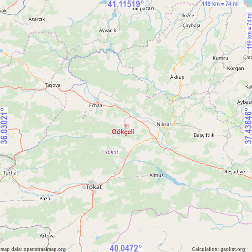
Gökçeli GPS coordinates[2]
40° 34' 59.988" North, 36° 43' 59.988" East
| Map corner | latitude | longitude |
|---|---|---|
| Upper-left | 41.11519°, | 36.03021° |
| Center: | 40.58333°, | 36.73333° |
| Lower-right: | 40.0472°, | 37.43646° |
| Map W x H: | 118.7×118.7 km | = 73.8×73.8mi |
| max Lat: | 42.02683° ⇑21.3% North |
| Gökçeli: | 40.58333° |
| min Lat: | ⇓78.7% South 35.9025° |
| min Long | Gökçeli | max Long |
| 25.90902° | 36.73333° | 44.60099° |
| W 55.9%⇐ | ⇒44.1% E |
Elevation
Elevation of Gökçeli is 693 m = 2274 ft, and this is 24.4 m = 80 ft below average elevation for this country.
| Max E: |
2682 m = 8799 ft | 50% |
| Avg. | 717.4 m = 2354 ft | |
| Gökçeli | 693 m = 2274 ft | |
Min E: |
0 m = 0 ft | 50% |
See also: Turkey elevation on elevation.city.
Geographical zone
Gökçeli is located in North temperate zone (between Tropic of Cancer and the Arctic Circle). Distance of this Northern Tropic circle is 1906.5 km =1184.6 mi to South.| Distance of | km | miles | from Gökçeli |
|---|---|---|---|
| North Pole | 5494.6 | 3414.2 | to North |
| Arctic Circle | 2888.7 | 1795 | to North |
| Tropic Cancer | 1906.5 | 1184.6 | to South |
| Equator | 4512.4 | 2803.9 | to South |


Nearby cities:
15 places around Gökçeli: (largest is in red/bold)
• Akkuş
33.4 km =20.8 mi,  45°
45°
• Almus
27.2 km =16.9 mi,  147°
147°
• Ayvacık
46.1 km =28.6 mi,  349°
349°
• Başçiftlik
37 km =23 mi,  96°
96°
• Doğanyurt
11.7 km =7.3 mi, 353°
• Erbaa
16.9 km =10.5 mi,  304°
304°
• Esençay
31.2 km =19.4 mi,  287°
287°
• Gökdere
12.4 km =7.7 mi,  172°
172°
• Karayaka
21.6 km =13.4 mi,  325°
325°
• Kozlu
21.7 km =13.5 mi,  277°
277°
• Niksar
18.5 km =11.5 mi,  87°
87°
• Taşova
39.8 km =24.7 mi, 299°
• Tokat
33.6 km =20.9 mi,  206°
206°
• Yeşilyurt
43 km =26.7 mi,  228°
228°
• Çamiçi
23 km =14.3 mi,  80°
80°
Sources, notices
• [Note1] Compared only with cities in Turkey existing in our database
• [Src1] Map data: © OpenStreetMap contributors (CC-BY-SA)
• [Src2] Other city data from geonames.org with taken over terms of usage.
• [Src3] Geographical zone / Annual Mean Temperature by Robert A. Rohde @ Wikipedia
