İçmeler geodata
İçmeler (Istanbul) is a populated place; located in Turkey in Europe/Istanbul (GMT+3) time zone. With population of 1,367 people, there are 1025 cities with bigger population in this country. Compared to other cities in Turkey, 84.6% of cities are located further ↓South; 81% of cities are located further →East and 95.5% of cities have higher elevation than İçmeler. Note1


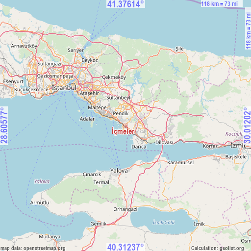
İçmeler GPS coordinates[2]
40° 50' 47.004" North, 29° 18' 32.004" East
| Map corner | latitude | longitude |
|---|---|---|
| Upper-left | 41.37614°, | 28.60577° |
| Center: | 40.84639°, | 29.30889° |
| Lower-right: | 40.31237°, | 30.01202° |
| Map W x H: | 118.3×118.3 km | = 73.5×73.5mi |
| max Lat: | 42.02683° ⇑15.4% North |
| İçmeler: | 40.84639° |
| min Lat: | ⇓84.6% South 35.9025° |
| min Long | İçmeler | max Long |
| 25.90902° | 29.30889° | 44.60099° |
| W 19%⇐ | ⇒81% E |
Elevation
Elevation of İçmeler is 15 m = 49 ft, and this is 702.4 m = 2304 ft below average elevation for this country.
| Max E: |
2682 m = 8799 ft | 95.5% |
| Avg. | 717.4 m = 2354 ft | |
| İçmeler | 15 m = 49 ft | |
Min E: |
0 m = 0 ft | 4.5% |
See also: Turkey elevation on elevation.city.
Geographical zone
İçmeler is located in North temperate zone (between Tropic of Cancer and the Arctic Circle). Distance of this Northern Tropic circle is 1935.8 km =1202.8 mi to South.| Distance of | km | miles | from İçmeler |
|---|---|---|---|
| North Pole | 5465.4 | 3396 | to North |
| Arctic Circle | 2859.5 | 1776.8 | to North |
| Tropic Cancer | 1935.8 | 1202.8 | to South |
| Equator | 4541.7 | 2822.1 | to South |


Nearby cities:
15 places around İçmeler: (largest is in red/bold)
• Adalan
18.7 km =11.6 mi,  280°
280°
• Adalar
15 km =9.3 mi, 279°
• Balçık
10.5 km =6.5 mi,  73°
73°
• Darıca
10.3 km =6.4 mi,  135°
135°
• Gebze
11.3 km =7 mi,  115°
115°
• Maltepe
16.3 km =10.1 mi,  307°
307°
• Mollafeneri
16.2 km =10.1 mi, 74°
• Pendik
4.6 km =2.9 mi,  318°
318°
• Samandıra
18.4 km =11.4 mi,  337°
337°
• Sancaktepe
18.5 km =11.5 mi, 339°
• Sultanbeyli
13.1 km =8.1 mi,  345°
345°
• Tavşanlı
17.3 km =10.7 mi,  100°
100°
• Taşköprü
20.4 km =12.7 mi,  160°
160°
• Çayırova
7.8 km =4.8 mi, 99°
• Çiftlikköy
20.7 km =12.9 mi,  176°
176°
Sources, notices
• [Note1] Compared only with cities in Turkey existing in our database
• [Src1] Map data: © OpenStreetMap contributors (CC-BY-SA)
• [Src2] Other city data from geonames.org with taken over terms of usage.
• [Src3] Geographical zone / Annual Mean Temperature by Robert A. Rohde @ Wikipedia
