Toga Village geodata
Toga Village (Nanumanga) is a seat of a first-order administrative division; located in Tuvalu in Pacific/Funafuti (GMT+12) time zone. With population of 258 people, there are 9 cities with bigger population in this country. Compared to other cities in Tuvalu, 90.9% of cities are located further ↓South; 100% of cities are located further →East and 90.9% of cities have lower elevation than Toga Village. Note1


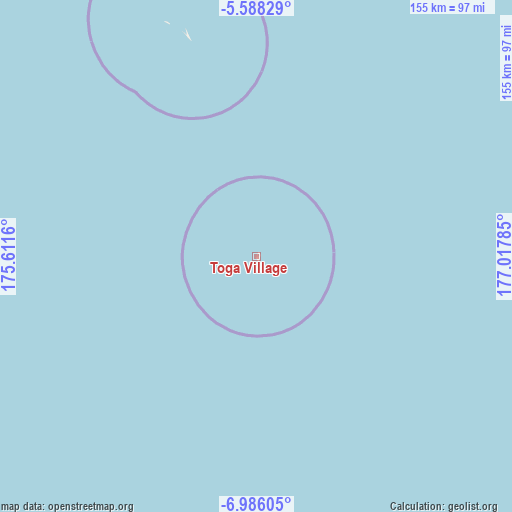
Toga Village GPS coordinates[2]
6° 17' 15.504" South, 176° 18' 52.992" East
| Map corner | latitude | longitude |
|---|---|---|
| Upper-left | -5.58829°, | 175.6116° |
| Center: | -6.28764°, | 176.31472° |
| Lower-right: | -6.98605°, | 177.01785° |
| Map W x H: | 155.4×155.4 km | = 96.6×96.6mi |
| max Lat: | -6.10819° ⇑9.1% North |
| Toga Village: | -6.28764° |
| min Lat: | ⇓90.9% South -8.52544° |
| min Long | Toga Village | max Long |
| 176.31472° | 176.31472° | 179.20094° |
| W 0%⇐ | ⇒100% E |
Elevation
Elevation of Toga Village is 11 m = 36 ft, and this is 2.7 m = 9 ft above average elevation for this country.
| Max E: |
12 m = 39 ft | 9.1% |
| Toga Village | 11 m 36 ft | |
| Avg. | 8.3 m = 27 ft | |
Min E: |
4 m = 13 ft | 90.9% |
See also: Tuvalu elevation on elevation.city.
Geographical zone
Toga Village is located in South Torrid zone (between Equator and Tropic of Capricorn). Distance of Equator is 699.1 km =434.4 mi to North.| Distance of | km | miles | from Toga Village |
|---|---|---|---|
| Equator | 699.1 | 434.4 | to North |
| Tropic Capricorn | 1906.8 | 1184.8 | to South |
| Antarctic Circle | 6702.1 | 4164.5 | to South |
| South Pole | 9307.9 | 5783.7 | to South |


Nearby cities:
11 places around Toga Village: (largest is in red/bold)
• Alapi Village
403.3 km =250.6 mi,  128°
128°
• Asau Village
293.4 km =182.3 mi,  117°
117°
• Fakaifou Village
403.4 km =250.7 mi, 127°
• Funafuti
403.3 km =250.6 mi, 128°
• Kulia Village
114.4 km =71.1 mi,  79°
79°
• Motufoua School
294.6 km =183.1 mi, 116°
• Savave Village
293.3 km =182.2 mi, 131°
• Senala Village
403.2 km =250.5 mi, 127°
• Tanrake Village
140.5 km =87.3 mi,  139°
139°
• Teone Village
401.7 km =249.6 mi, 127°
• Vaiaku Village
403.4 km =250.7 mi, 128°
Sources, notices
• [Note1] Compared only with cities in Tuvalu existing in our database
• [Src1] Map data: © OpenStreetMap contributors (CC-BY-SA)
• [Src2] Other city data from geonames.org with taken over terms of usage.
• [Src3] Geographical zone / Annual Mean Temperature by Robert A. Rohde @ Wikipedia
