Senala Village geodata
Senala Village (Funafuti) is a section of populated place; located in Tuvalu in Pacific/Funafuti (GMT+12) time zone. With population of 589 people, there are 3 cities with bigger population in this country. Compared to other cities in Tuvalu, 63.6% of cities are located further ↑North; 90.9% of cities are located further ←West and 54.5% of cities have higher elevation than Senala Village. Note1


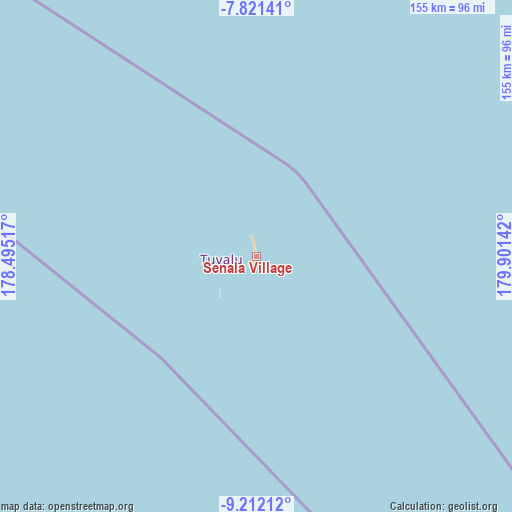
Senala Village GPS coordinates[2]
8° 31' 2.64" South, 179° 11' 53.844" East
| Map corner | latitude | longitude |
|---|---|---|
| Upper-left | -7.82141°, | 178.49517° |
| Center: | -8.5174°, | 179.19829° |
| Lower-right: | -9.21212°, | 179.90142° |
| Map W x H: | 154.6×154.6 km | = 96.1×96.1mi |
| max Lat: | -6.10819° ⇑63.6% North |
| Senala Village: | -8.5174° |
| min Lat: | ⇓36.4% South -8.52544° |
| min Long | Senala Village | max Long |
| 176.31472° | 179.19829° | 179.20094° |
| W 90.9%⇐ | ⇒9.1% E |
Elevation
Elevation of Senala Village is 8 m = 26 ft, and this is 0.3 m = 1 ft below average elevation for this country.
| Max E: |
12 m = 39 ft | 54.5% |
| Avg. | 8.3 m = 27 ft | |
| Senala Village | 8 m = 26 ft | |
Min E: |
4 m = 13 ft | 45.5% |
See also: Tuvalu elevation on elevation.city.
Geographical zone
Senala Village is located in South Torrid zone (between Equator and Tropic of Capricorn). Distance of Equator is 947 km =588.4 mi to North.| Distance of | km | miles | from Senala Village |
|---|---|---|---|
| Equator | 947 | 588.4 | to North |
| Tropic Capricorn | 1658.9 | 1030.8 | to South |
| Antarctic Circle | 6454.1 | 4010.4 | to South |
| South Pole | 9060 | 5629.6 | to South |


Nearby cities:
11 places around Senala Village: (largest is in red/bold)
• Alapi Village
0.4 km =0.2 mi,  203°
203°
• Asau Village
127.7 km =79.3 mi,  333°
333°
• Fakaifou Village
0.3 km =0.2 mi,  93°
93°
• Funafuti
0.9 km =0.6 mi,  210°
210°
• Kulia Village
337.7 km =209.8 mi,  322°
322°
• Motufoua School
127.1 km =79 mi, 334°
• Savave Village
111.6 km =69.3 mi,  299°
299°
• Tanrake Village
266.7 km =165.7 mi, 302°
• Teone Village
2.1 km =1.3 mi,  349°
349°
• Toga Village
403.2 km =250.5 mi,  307°
307°
• Vaiaku Village
1 km =0.6 mi, 207°
Sources, notices
• [Note1] Compared only with cities in Tuvalu existing in our database
• [Src1] Map data: © OpenStreetMap contributors (CC-BY-SA)
• [Src2] Other city data from geonames.org with taken over terms of usage.
• [Src3] Geographical zone / Annual Mean Temperature by Robert A. Rohde @ Wikipedia
