Motufoua School geodata
Motufoua School (Vaitupu) is a populated place; located in Tuvalu in Pacific/Funafuti (GMT+12) time zone. With population of 506 people, there are 7 cities with bigger population in this country. Compared to other cities in Tuvalu, 72.7% of cities are located further ↓South; 54.5% of cities are located further →East and 72.7% of cities have lower elevation than Motufoua School. Note1


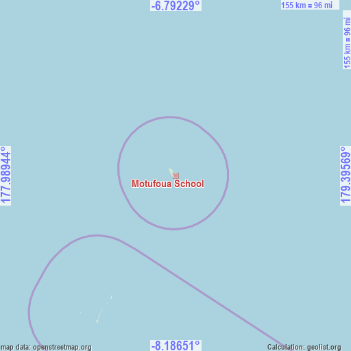
Motufoua School GPS coordinates[2]
7° 29' 23.856" South, 178° 41' 33.216" East
| Map corner | latitude | longitude |
|---|---|---|
| Upper-left | -6.79229°, | 177.98944° |
| Center: | -7.48996°, | 178.69256° |
| Lower-right: | -8.18651°, | 179.39569° |
| Map W x H: | 155×155 km | = 96.3×96.3mi |
| max Lat: | -6.10819° ⇑27.3% North |
| Motufoua School: | -7.48996° |
| min Lat: | ⇓72.7% South -8.52544° |
| min Long | Motufoua School | max Long |
| 176.31472° | 178.69256° | 179.20094° |
| W 45.5%⇐ | ⇒54.5% E |
Elevation
Elevation of Motufoua School is 10 m = 33 ft, and this is 1.7 m = 6 ft above average elevation for this country.
| Max E: |
12 m = 39 ft | 27.3% |
| Motufoua School | 10 m 33 ft | |
| Avg. | 8.3 m = 27 ft | |
Min E: |
4 m = 13 ft | 72.7% |
See also: Tuvalu elevation on elevation.city.
Geographical zone
Motufoua School is located in South Torrid zone (between Equator and Tropic of Capricorn). Distance of Equator is 832.8 km =517.5 mi to North.| Distance of | km | miles | from Motufoua School |
|---|---|---|---|
| Equator | 832.8 | 517.5 | to North |
| Tropic Capricorn | 1773.1 | 1101.8 | to South |
| Antarctic Circle | 6568.4 | 4081.4 | to South |
| South Pole | 9174.3 | 5700.6 | to South |


Nearby cities:
11 places around Motufoua School: (largest is in red/bold)
• Alapi Village
127.4 km =79.2 mi,  154°
154°
• Asau Village
1.4 km =0.9 mi,  268°
268°
• Fakaifou Village
127.2 km =79 mi, 153°
• Funafuti
127.6 km =79.3 mi, 154°
• Kulia Village
214.7 km =133.4 mi,  315°
315°
• Savave Village
72.9 km =45.3 mi,  214°
214°
• Senala Village
127.1 km =79 mi, 154°
• Tanrake Village
172.8 km =107.4 mi,  279°
279°
• Teone Village
125.1 km =77.7 mi, 153°
• Toga Village
294.6 km =183.1 mi,  296°
296°
• Vaiaku Village
127.7 km =79.3 mi, 154°
Sources, notices
• [Note1] Compared only with cities in Tuvalu existing in our database
• [Src1] Map data: © OpenStreetMap contributors (CC-BY-SA)
• [Src2] Other city data from geonames.org with taken over terms of usage.
• [Src3] Geographical zone / Annual Mean Temperature by Robert A. Rohde @ Wikipedia
