Tanrake Village geodata
Tanrake Village (Nui) is a seat of a first-order administrative division; located in Tuvalu in Pacific/Funafuti (GMT+12) time zone. With population of 408 people, there are 8 cities with bigger population in this country. Compared to other cities in Tuvalu, 81.8% of cities are located further ↓South; 90.9% of cities are located further →East and 100% of cities have higher elevation than Tanrake Village. Note1


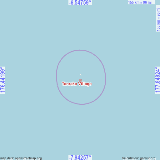
Tanrake Village GPS coordinates[2]
7° 14' 44.232" South, 177° 8' 42.396" East
| Map corner | latitude | longitude |
|---|---|---|
| Upper-left | -6.54759°, | 176.44199° |
| Center: | -7.24562°, | 177.14511° |
| Lower-right: | -7.94257°, | 177.84824° |
| Map W x H: | 155.1×155.1 km | = 96.4×96.4mi |
| max Lat: | -6.10819° ⇑18.2% North |
| Tanrake Village: | -7.24562° |
| min Lat: | ⇓81.8% South -8.52544° |
| min Long | Tanrake Village | max Long |
| 176.31472° | 177.14511° | 179.20094° |
| W 9.1%⇐ | ⇒90.9% E |
Elevation
Elevation of Tanrake Village is 4 m = 13 ft, and this is 4.3 m = 14 ft below average elevation for this country.
| Max E: |
12 m = 39 ft | 100% |
| Avg. | 8.3 m = 27 ft | |
| Tanrake Village | 4 m = 13 ft | |
Min E: |
4 m = 13 ft | 0% |
See also: Tuvalu elevation on elevation.city.
Geographical zone
Tanrake Village is located in South Torrid zone (between Equator and Tropic of Capricorn). Distance of Equator is 805.6 km =500.6 mi to North.| Distance of | km | miles | from Tanrake Village |
|---|---|---|---|
| Equator | 805.6 | 500.6 | to North |
| Tropic Capricorn | 1800.3 | 1118.7 | to South |
| Antarctic Circle | 6595.5 | 4098.3 | to South |
| South Pole | 9201.4 | 5717.5 | to South |


Nearby cities:
11 places around Tanrake Village: (largest is in red/bold)
• Alapi Village
266.8 km =165.8 mi,  122°
122°
• Asau Village
171.4 km =106.5 mi,  99°
99°
• Fakaifou Village
267 km =165.9 mi, 121°
• Funafuti
266.7 km =165.7 mi, 122°
• Kulia Village
128.2 km =79.7 mi,  9°
9°
• Motufoua School
172.8 km =107.4 mi, 99°
• Savave Village
155.4 km =96.6 mi, 124°
• Senala Village
266.7 km =165.7 mi, 122°
• Teone Village
265.3 km =164.8 mi, 121°
• Toga Village
140.5 km =87.3 mi,  319°
319°
• Vaiaku Village
266.8 km =165.8 mi, 122°
Sources, notices
• [Note1] Compared only with cities in Tuvalu existing in our database
• [Src1] Map data: © OpenStreetMap contributors (CC-BY-SA)
• [Src2] Other city data from geonames.org with taken over terms of usage.
• [Src3] Geographical zone / Annual Mean Temperature by Robert A. Rohde @ Wikipedia
