Kurskoye geodata
Kurskoye (Republic of Crimea) is a seat of a third-order administrative division; located in Ukraine in Europe/Simferopol (GMT+3) time zone. With population of 1,204 people, there are 1295 cities with bigger population in this country. Compared to other cities in Ukraine, 90.5% of cities are located further ↑North; 79.5% of cities are located further ←West and 71.2% of cities have lower elevation than Kurskoye. Note1
Administrative division(s):
- Level 1: Republic of Crimea
- Level 2: Belogorskiy rayon
- Level 3: Kurskoye sel'skoye poselenye


Kurskoye GPS coordinates[2]
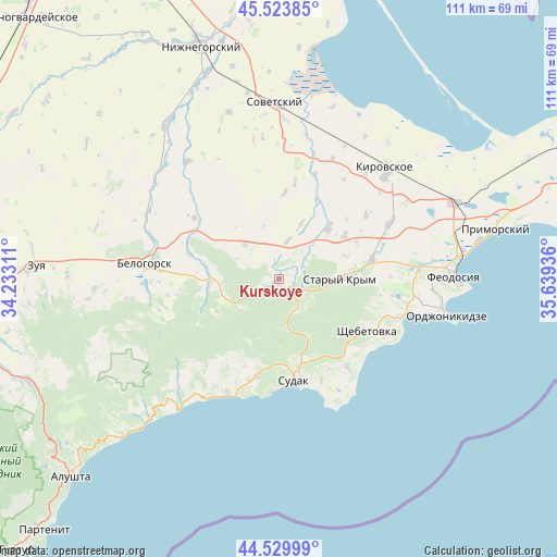
45° 1' 44.688" North, 34° 56' 10.428" East
| Map corner | latitude | longitude |
|---|---|---|
| Upper-left | 45.52385°, | 34.23311° |
| Center: | 45.02908°, | 34.93623° |
| Lower-right: | 44.52999°, | 35.63936° |
| Map W x H: | 110.5×110.5 km | = 68.7×68.7mi |
| max Lat: | 52.18903° ⇑90.5% North |
| Kurskoye: | 45.02908° |
| min Lat: | ⇓9.5% South 44.39214° |
| min Long | Kurskoye | max Long |
| 22.20555° | 34.93623° | 40.13222° |
| W 79.5%⇐ | ⇒20.5% E |
Elevation
Elevation of Kurskoye is 211 m = 692 ft, and this is 55.2 m = 181 ft above average elevation for this country.
| Max E: |
886 m = 2907 ft | 28.8% |
| Kurskoye | 211 m 692 ft | |
| Avg. | 155.8 m = 511 ft | |
Min E: |
-3 m = -10 ft | 71.2% |
See also: Ukraine elevation on elevation.city.
Geographical zone
Kurskoye is located in North temperate zone (between Tropic of Cancer and the Arctic Circle). Distance of this North polar circle is 2394.4 km =1487.8 mi to North.| Distance of | km | miles | from Kurskoye |
|---|---|---|---|
| North Pole | 5000.3 | 3107 | to North |
| Arctic Circle | 2394.4 | 1487.8 | to North |
| Tropic Cancer | 2400.8 | 1491.8 | to South |
| Equator | 5006.8 | 3111.1 | to South |


Nearby cities:
15 places around Kurskoye: (largest is in red/bold)
• Abrikosovka
15.6 km =9.7 mi,  56°
56°
• Bogatoye
13.3 km =8.3 mi,  270°
270°
• Grushevka
3 km =1.9 mi,  103°
103°
• Izyumovka
15.9 km =9.9 mi,  83°
83°
• Kholodovka
5.2 km =3.2 mi, 59°
• Krasnokamenka
16 km =9.9 mi,  136°
136°
• Lechebnoye
15 km =9.3 mi,  279°
279°
• Lesnoye
9.9 km =6.2 mi,  172°
172°
• L’govskoye
7.8 km =4.8 mi,  12°
12°
• Muromskoye
9.7 km =6 mi,  314°
314°
• Perevalovka
6.9 km =4.3 mi,  147°
147°
• Privetnoye
14 km =8.7 mi,  43°
43°
• Stary Krym
12.2 km =7.6 mi,  90°
90°
• Zemlyanichnoye
10 km =6.2 mi,  232°
232°
• Zolotoye Pole
11.8 km =7.3 mi,  21°
21°
Sources, notices
• [Note1] Compared only with cities in Ukraine existing in our database
• [Src1] Map data: © OpenStreetMap contributors (CC-BY-SA)
• [Src2] Other city data from geonames.org with taken over terms of usage.
• [Src3] Geographical zone / Annual Mean Temperature by Robert A. Rohde @ Wikipedia
