Drofino geodata
Drofino (Republic of Crimea) is a seat of a third-order administrative division; located in Ukraine in Europe/Simferopol (GMT+3) time zone. With population of 779 people, there are 1499 cities with bigger population in this country. Compared to other cities in Ukraine, 83.1% of cities are located further ↑North; 75% of cities are located further ←West and 74.5% of cities have higher elevation than Drofino. Note1
Administrative division(s):
- Level 1: Republic of Crimea
- Level 2: Nizhnegorskiy rayon
- Level 3: Drofinskoye sel'skoye poselenye


Drofino GPS coordinates[2]
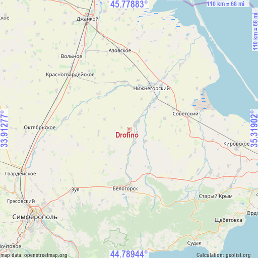
45° 17' 10.644" North, 34° 36' 57.204" East
| Map corner | latitude | longitude |
|---|---|---|
| Upper-left | 45.77883°, | 33.91277° |
| Center: | 45.28629°, | 34.61589° |
| Lower-right: | 44.78944°, | 35.31902° |
| Map W x H: | 110×110 km | = 68.4×68.4mi |
| max Lat: | 52.18903° ⇑83.1% North |
| Drofino: | 45.28629° |
| min Lat: | ⇓16.9% South 44.39214° |
| min Long | Drofino | max Long |
| 22.20555° | 34.61589° | 40.13222° |
| W 75%⇐ | ⇒25% E |
Elevation
Elevation of Drofino is 62 m = 203 ft, and this is 93.8 m = 308 ft below average elevation for this country.
| Max E: |
886 m = 2907 ft | 74.5% |
| Avg. | 155.8 m = 511 ft | |
| Drofino | 62 m = 203 ft | |
Min E: |
-3 m = -10 ft | 25.5% |
See also: Ukraine elevation on elevation.city.
Geographical zone
Drofino is located in North temperate zone (between Tropic of Cancer and the Arctic Circle). Distance of this North polar circle is 2365.8 km =1470 mi to North.| Distance of | km | miles | from Drofino |
|---|---|---|---|
| North Pole | 4971.7 | 3089.3 | to North |
| Arctic Circle | 2365.8 | 1470 | to North |
| Tropic Cancer | 2429.4 | 1509.6 | to South |
| Equator | 5035.4 | 3128.9 | to South |


Nearby cities:
15 places around Drofino: (largest is in red/bold)
• Frunze
7.5 km =4.7 mi,  78°
78°
• Ivanovka
12.7 km =7.9 mi,  39°
39°
• Kostochkovka
5.7 km =3.5 mi,  52°
52°
• Lomonosovo
13.9 km =8.6 mi,  22°
22°
• Naydenovka
13.2 km =8.2 mi,  262°
262°
• Pavlovka
14.3 km =8.9 mi,  146°
146°
• Pchel’niki
13.2 km =8.2 mi,  85°
85°
• Prudy
8.5 km =5.3 mi,  127°
127°
• Sadovoye
3.9 km =2.4 mi, 46°
• Vishennoye
15.8 km =9.8 mi,  185°
185°
• Zarech’ye
11.2 km =7 mi, 41°
• Zavetnoye
15.7 km =9.8 mi,  73°
73°
• Zernovoye
11.3 km =7 mi,  291°
291°
• Zhemchuzhina
3.5 km =2.2 mi,  111°
111°
• Zybiny
6.1 km =3.8 mi, 154°
Sources, notices
• [Note1] Compared only with cities in Ukraine existing in our database
• [Src1] Map data: © OpenStreetMap contributors (CC-BY-SA)
• [Src2] Other city data from geonames.org with taken over terms of usage.
• [Src3] Geographical zone / Annual Mean Temperature by Robert A. Rohde @ Wikipedia
