Pchel’niki geodata
Pchel’niki (Republic of Crimea) is a populated place; located in Ukraine in Europe/Simferopol (GMT+3) time zone. With population of 528 people, there are 1635 cities with bigger population in this country. Compared to other cities in Ukraine, 82.6% of cities are located further ↑North; 77.5% of cities are located further ←West and 78.1% of cities have higher elevation than Pchel’niki. Note1
Administrative division(s):
- Level 1: Republic of Crimea
- Level 2: Sovietskyi Raion
- Level 3: Zavetnenskoye sel'skoye poselenye


Pchel’niki GPS coordinates[2]
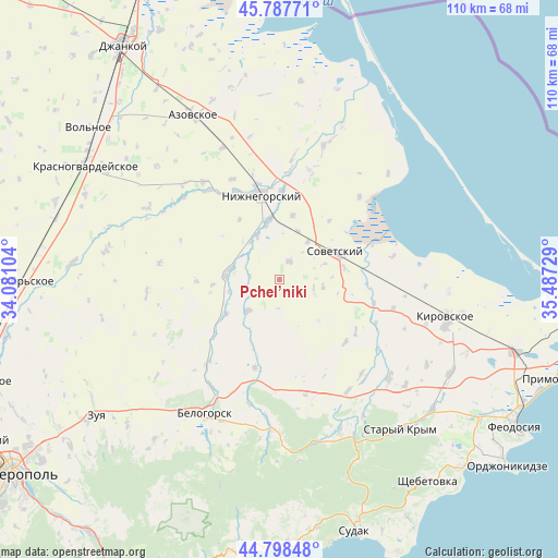
45° 17' 42.9" North, 34° 47' 2.976" East
| Map corner | latitude | longitude |
|---|---|---|
| Upper-left | 45.78771°, | 34.08104° |
| Center: | 45.29525°, | 34.78416° |
| Lower-right: | 44.79848°, | 35.48729° |
| Map W x H: | 110×110 km | = 68.4×68.4mi |
| max Lat: | 52.18903° ⇑82.6% North |
| Pchel’niki: | 45.29525° |
| min Lat: | ⇓17.4% South 44.39214° |
| min Long | Pchel’niki | max Long |
| 22.20555° | 34.78416° | 40.13222° |
| W 77.5%⇐ | ⇒22.5% E |
Elevation
Elevation of Pchel’niki is 50 m = 164 ft, and this is 105.8 m = 347 ft below average elevation for this country.
| Max E: |
886 m = 2907 ft | 78.1% |
| Avg. | 155.8 m = 511 ft | |
| Pchel’niki | 50 m = 164 ft | |
Min E: |
-3 m = -10 ft | 21.9% |
See also: Ukraine elevation on elevation.city.
Geographical zone
Pchel’niki is located in North temperate zone (between Tropic of Cancer and the Arctic Circle). Distance of this North polar circle is 2364.8 km =1469.4 mi to North.| Distance of | km | miles | from Pchel’niki |
|---|---|---|---|
| North Pole | 4970.7 | 3088.6 | to North |
| Arctic Circle | 2364.8 | 1469.4 | to North |
| Tropic Cancer | 2430.4 | 1510.2 | to South |
| Equator | 5036.4 | 3129.5 | to South |


Nearby cities:
15 places around Pchel’niki: (largest is in red/bold)
• Chapayevka
8.8 km =5.5 mi,  100°
100°
• Frunze
5.8 km =3.6 mi,  275°
275°
• Ivanovka
10.1 km =6.3 mi,  330°
330°
• Kostochkovka
8.9 km =5.5 mi,  286°
286°
• Novy Mir
6.9 km =4.3 mi, 103°
• Prudy
8.9 km =5.5 mi,  225°
225°
• Razdol’noye
9.2 km =5.7 mi,  36°
36°
• Sadovoye
10.4 km =6.5 mi, 279°
• Sovetskiy
12.2 km =7.6 mi,  64°
64°
• Varvarovka
9.5 km =5.9 mi,  70°
70°
• Zarech’ye
9.4 km =5.8 mi,  322°
322°
• Zavetnoye
4 km =2.5 mi,  28°
28°
• Zhelyabovka
11.7 km =7.3 mi,  349°
349°
• Zhemchuzhina
10.1 km =6.3 mi,  256°
256°
• Zybiny
12.4 km =7.7 mi,  238°
238°
Sources, notices
• [Note1] Compared only with cities in Ukraine existing in our database
• [Src1] Map data: © OpenStreetMap contributors (CC-BY-SA)
• [Src2] Other city data from geonames.org with taken over terms of usage.
• [Src3] Geographical zone / Annual Mean Temperature by Robert A. Rohde @ Wikipedia
