Zernovoye geodata
Zernovoye (Republic of Crimea) is a seat of a third-order administrative division; located in Ukraine in Europe/Simferopol (GMT+3) time zone. With population of 1,023 people, there are 1365 cities with bigger population in this country. Compared to other cities in Ukraine, 81.9% of cities are located further ↑North; 73.2% of cities are located further ←West and 69.8% of cities have higher elevation than Zernovoye. Note1
Administrative division(s):
- Level 1: Republic of Crimea
- Level 2: Krasnohvardiiske Raion
- Level 3: Zernovskoye sel'skoye poselenye


Zernovoye GPS coordinates[2]
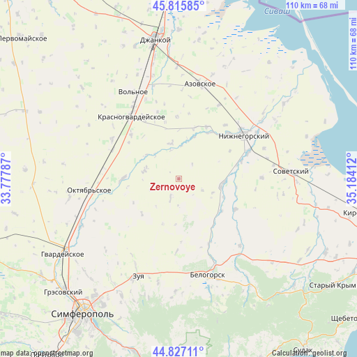
45° 19' 25.104" North, 34° 28' 51.564" East
| Map corner | latitude | longitude |
|---|---|---|
| Upper-left | 45.81585°, | 33.77787° |
| Center: | 45.32364°, | 34.48099° |
| Lower-right: | 44.82711°, | 35.18412° |
| Map W x H: | 109.9×109.9 km | = 68.3×68.3mi |
| max Lat: | 52.18903° ⇑81.9% North |
| Zernovoye: | 45.32364° |
| min Lat: | ⇓18.1% South 44.39214° |
| min Long | Zernovoye | max Long |
| 22.20555° | 34.48099° | 40.13222° |
| W 73.2%⇐ | ⇒26.8% E |
Elevation
Elevation of Zernovoye is 76 m = 249 ft, and this is 79.8 m = 262 ft below average elevation for this country.
| Max E: |
886 m = 2907 ft | 69.8% |
| Avg. | 155.8 m = 511 ft | |
| Zernovoye | 76 m = 249 ft | |
Min E: |
-3 m = -10 ft | 30.2% |
See also: Ukraine elevation on elevation.city.
Geographical zone
Zernovoye is located in North temperate zone (between Tropic of Cancer and the Arctic Circle). Distance of this North polar circle is 2361.7 km =1467.5 mi to North.| Distance of | km | miles | from Zernovoye |
|---|---|---|---|
| North Pole | 4967.5 | 3086.7 | to North |
| Arctic Circle | 2361.7 | 1467.5 | to North |
| Tropic Cancer | 2433.6 | 1512.2 | to South |
| Equator | 5039.5 | 3131.4 | to South |


Nearby cities:
15 places around Zernovoye: (largest is in red/bold)
• Drofino
11.3 km =7 mi,  111°
111°
• Kolodeznoye
15.6 km =9.7 mi,  226°
226°
• Kostochkovka
15.1 km =9.4 mi,  92°
92°
• Mel’nichnoye
14.7 km =9.1 mi,  198°
198°
• Molochnoye
12.4 km =7.7 mi,  307°
307°
• Muskatnoye
16.5 km =10.3 mi,  17°
17°
• Naydenovka
6.4 km =4 mi, 203°
• Novogrigoryevka
17.2 km =10.7 mi,  33°
33°
• Novopokrovka
11.2 km =7 mi,  347°
347°
• Pyatikhatka
17.7 km =11 mi,  269°
269°
• Rovnoye
10.5 km =6.5 mi,  287°
287°
• Sadovoye
13.5 km =8.4 mi,  96°
96°
• Udachnoye
17.2 km =10.7 mi, 294°
• Zhemchuzhina
14.9 km =9.3 mi, 111°
• Zybiny
16.4 km =10.2 mi,  126°
126°
Sources, notices
• [Note1] Compared only with cities in Ukraine existing in our database
• [Src1] Map data: © OpenStreetMap contributors (CC-BY-SA)
• [Src2] Other city data from geonames.org with taken over terms of usage.
• [Src3] Geographical zone / Annual Mean Temperature by Robert A. Rohde @ Wikipedia
