Sovkhoznoye geodata
Sovkhoznoye (Republic of Crimea) is a seat of a third-order administrative division; located in Ukraine in Europe/Simferopol (GMT+3) time zone. With population of 1,330 people, there are 1257 cities with bigger population in this country. Compared to other cities in Ukraine, 70.1% of cities are located further ↑North; 56.9% of cities are located further ←West and 98.6% of cities have higher elevation than Sovkhoznoye. Note1
Administrative division(s):
- Level 1: Republic of Crimea
- Level 2: Krasnoperekopsk Raion
- Level 3: Sovkhoznenskoye sel'skoye poselenye


Sovkhoznoye GPS coordinates[2]
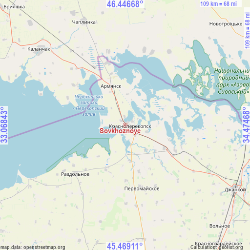
45° 57' 36.18" North, 33° 46' 17.58" East
| Map corner | latitude | longitude |
|---|---|---|
| Upper-left | 46.44668°, | 33.06843° |
| Center: | 45.96005°, | 33.77155° |
| Lower-right: | 45.46911°, | 34.47468° |
| Map W x H: | 108.7×108.7 km | = 67.5×67.5mi |
| max Lat: | 52.18903° ⇑70.1% North |
| Sovkhoznoye: | 45.96005° |
| min Lat: | ⇓29.9% South 44.39214° |
| min Long | Sovkhoznoye | max Long |
| 22.20555° | 33.77155° | 40.13222° |
| W 56.9%⇐ | ⇒43.1% E |
Elevation
Elevation of Sovkhoznoye is 6 m = 20 ft, and this is 149.8 m = 491 ft below average elevation for this country.
| Max E: |
886 m = 2907 ft | 98.6% |
| Avg. | 155.8 m = 511 ft | |
| Sovkhoznoye | 6 m = 20 ft | |
Min E: |
-3 m = -10 ft | 1.4% |
See also: Ukraine elevation on elevation.city.
Geographical zone
Sovkhoznoye is located in North temperate zone (between Tropic of Cancer and the Arctic Circle). Distance of this North polar circle is 2290.9 km =1423.5 mi to North.| Distance of | km | miles | from Sovkhoznoye |
|---|---|---|---|
| North Pole | 4896.8 | 3042.7 | to North |
| Arctic Circle | 2290.9 | 1423.5 | to North |
| Tropic Cancer | 2504.4 | 1556.2 | to South |
| Equator | 5110.3 | 3175.4 | to South |


Nearby cities:
15 places around Sovkhoznoye: (largest is in red/bold)
• Armyansk
17.7 km =11 mi,  339°
339°
• Bratskoye
18.4 km =11.4 mi,  140°
140°
• Dolinka
17.1 km =10.6 mi,  129°
129°
• Filatovka
13.6 km =8.5 mi,  4°
4°
• Ilyinka
15.9 km =9.9 mi,  173°
173°
• Ishun’
5.7 km =3.5 mi, 134°
• Krasnoperekops’k
2 km =1.2 mi,  99°
99°
• Kumovo
18 km =11.2 mi,  220°
220°
• Novopavlovka
13.9 km =8.6 mi, 138°
• Pochetnoye
3.9 km =2.4 mi,  353°
353°
• Risovoye
9.6 km =6 mi,  320°
320°
• Suvorovo
15.7 km =9.8 mi, 335°
• Tavricheskoye
2.5 km =1.6 mi, 316°
• Vishnyovka
14 km =8.7 mi,  90°
90°
• Zelyonaya Niva
9.7 km =6 mi,  106°
106°
Sources, notices
• [Note1] Compared only with cities in Ukraine existing in our database
• [Src1] Map data: © OpenStreetMap contributors (CC-BY-SA)
• [Src2] Other city data from geonames.org with taken over terms of usage.
• [Src3] Geographical zone / Annual Mean Temperature by Robert A. Rohde @ Wikipedia
