Armyansk geodata
Armyansk (Republic of Crimea) is a seat of a second-order administrative division; located in Ukraine in Europe/Simferopol (GMT+3) time zone. With population of 24,442 people, there are 169 cities with bigger population in this country. Compared to other cities in Ukraine, 69.2% of cities are located further ↑North; 55.2% of cities are located further ←West and 92.2% of cities have higher elevation than Armyansk. Note1


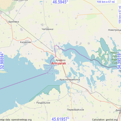
Armyansk GPS coordinates[2]
46° 6' 33.084" North, 33° 41' 31.416" East
| Map corner | latitude | longitude |
|---|---|---|
| Upper-left | 46.5945°, | 32.98894° |
| Center: | 46.10919°, | 33.69206° |
| Lower-right: | 45.61957°, | 34.39519° |
| Map W x H: | 108.4×108.4 km | = 67.4×67.4mi |
| max Lat: | 52.18903° ⇑69.2% North |
| Armyansk: | 46.10919° |
| min Lat: | ⇓30.8% South 44.39214° |
| min Long | Armyansk | max Long |
| 22.20555° | 33.69206° | 40.13222° |
| W 55.2%⇐ | ⇒44.8% E |
Elevation
Elevation of Armyansk is 16 m = 52 ft, and this is 139.8 m = 459 ft below average elevation for this country.
| Max E: |
886 m = 2907 ft | 92.2% |
| Avg. | 155.8 m = 511 ft | |
| Armyansk | 16 m = 52 ft | |
Min E: |
-3 m = -10 ft | 7.8% |
See also: Ukraine elevation on elevation.city.
Geographical zone
Armyansk is located in North temperate zone (between Tropic of Cancer and the Arctic Circle). Distance of this North polar circle is 2274.3 km =1413.2 mi to North.| Distance of | km | miles | from Armyansk |
|---|---|---|---|
| North Pole | 4880.2 | 3032.4 | to North |
| Arctic Circle | 2274.3 | 1413.2 | to North |
| Tropic Cancer | 2520.9 | 1566.4 | to South |
| Equator | 5126.9 | 3185.7 | to South |


Nearby cities:
15 places around Armyansk: (largest is in red/bold)
• Chaplynka
30.8 km =19.1 mi,  337°
337°
• Filatovka
7.8 km =4.8 mi,  112°
112°
• Ishun’
23 km =14.3 mi,  153°
153°
• Krasnoarmeyskoye
29.2 km =18.1 mi,  116°
116°
• Krasnoperekops’k
18.7 km =11.6 mi, 154°
• Kumovo
30.7 km =19.1 mi,  190°
190°
• Novopavlovka
31 km =19.3 mi, 150°
• Perekop
5.8 km =3.6 mi,  0°
0°
• Pochetnoye
13.9 km =8.6 mi,  155°
155°
• Risovoye
9.1 km =5.7 mi,  179°
179°
• Sovkhoznoye
17.7 km =11 mi, 159°
• Suvorovo
2.3 km =1.4 mi, 187°
• Tavricheskoye
15.4 km =9.6 mi, 163°
• Vishnyovka
26.1 km =16.2 mi,  129°
129°
• Zelyonaya Niva
24.7 km =15.3 mi,  141°
141°
Sources, notices
• [Note1] Compared only with cities in Ukraine existing in our database
• [Src1] Map data: © OpenStreetMap contributors (CC-BY-SA)
• [Src2] Other city data from geonames.org with taken over terms of usage.
• [Src3] Geographical zone / Annual Mean Temperature by Robert A. Rohde @ Wikipedia
