Filatovka geodata
Filatovka (Republic of Crimea) is a seat of a third-order administrative division; located in Ukraine in Europe/Simferopol (GMT+3) time zone. With population of 516 people, there are 1645 cities with bigger population in this country. Compared to other cities in Ukraine, 69.4% of cities are located further ↑North; 57.4% of cities are located further ←West and 96.8% of cities have higher elevation than Filatovka. Note1
Administrative division(s):
- Level 1: Republic of Crimea
- Level 2: Krasnoperekopsk Raion
- Level 3: Filatovskoye sel'skoye poselenye


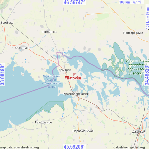
Filatovka GPS coordinates[2]
46° 4' 54.912" North, 33° 47' 6.36" East
| Map corner | latitude | longitude |
|---|---|---|
| Upper-left | 46.56747°, | 33.08198° |
| Center: | 46.08192°, | 33.7851° |
| Lower-right: | 45.59206°, | 34.48823° |
| Map W x H: | 108.5×108.5 km | = 67.4×67.4mi |
| max Lat: | 52.18903° ⇑69.4% North |
| Filatovka: | 46.08192° |
| min Lat: | ⇓30.6% South 44.39214° |
| min Long | Filatovka | max Long |
| 22.20555° | 33.7851° | 40.13222° |
| W 57.4%⇐ | ⇒42.6% E |
Elevation
Elevation of Filatovka is 9 m = 30 ft, and this is 146.8 m = 482 ft below average elevation for this country.
| Max E: |
886 m = 2907 ft | 96.8% |
| Avg. | 155.8 m = 511 ft | |
| Filatovka | 9 m = 30 ft | |
Min E: |
-3 m = -10 ft | 3.2% |
See also: Ukraine elevation on elevation.city.
Geographical zone
Filatovka is located in North temperate zone (between Tropic of Cancer and the Arctic Circle). Distance of this North polar circle is 2277.3 km =1415 mi to North.| Distance of | km | miles | from Filatovka |
|---|---|---|---|
| North Pole | 4883.2 | 3034.3 | to North |
| Arctic Circle | 2277.3 | 1415 | to North |
| Tropic Cancer | 2517.9 | 1564.6 | to South |
| Equator | 5123.8 | 3183.8 | to South |


Nearby cities:
15 places around Filatovka: (largest is in red/bold)
• Armyansk
7.8 km =4.8 mi,  292°
292°
• Dolinka
27.3 km =17 mi,  153°
153°
• Ishun’
17.8 km =11.1 mi,  170°
170°
• Istochnoye
27 km =16.8 mi,  136°
136°
• Krasnoarmeyskoye
21.5 km =13.4 mi,  118°
118°
• Krasnoperekops’k
13.9 km =8.6 mi,  176°
176°
• Novopavlovka
25.3 km =15.7 mi,  161°
161°
• Perekop
11.3 km =7 mi,  321°
321°
• Pochetnoye
9.8 km =6.1 mi,  188°
188°
• Risovoye
9.4 km =5.8 mi,  229°
229°
• Sovkhoznoye
13.6 km =8.5 mi, 184°
• Suvorovo
7.5 km =4.7 mi,  275°
275°
• Tavricheskoye
12 km =7.5 mi, 193°
• Vishnyovka
18.8 km =11.7 mi, 136°
• Zelyonaya Niva
18.3 km =11.4 mi, 153°
Sources, notices
• [Note1] Compared only with cities in Ukraine existing in our database
• [Src1] Map data: © OpenStreetMap contributors (CC-BY-SA)
• [Src2] Other city data from geonames.org with taken over terms of usage.
• [Src3] Geographical zone / Annual Mean Temperature by Robert A. Rohde @ Wikipedia
