Prudovoye geodata
Prudovoye (Republic of Crimea) is a populated place; located in Ukraine in Europe/Simferopol (GMT+3) time zone. With population of 1,009 people, there are 1374 cities with bigger population in this country. Compared to other cities in Ukraine, 93.1% of cities are located further ↑North; 57.2% of cities are located further ←West and 54% of cities have higher elevation than Prudovoye. Note1
Administrative division(s):
- Level 1: Republic of Crimea
- Level 2: Simferopol Raion
- Level 3: Kol'chuginskoye sel'skoye poselenye


Prudovoye GPS coordinates[2]
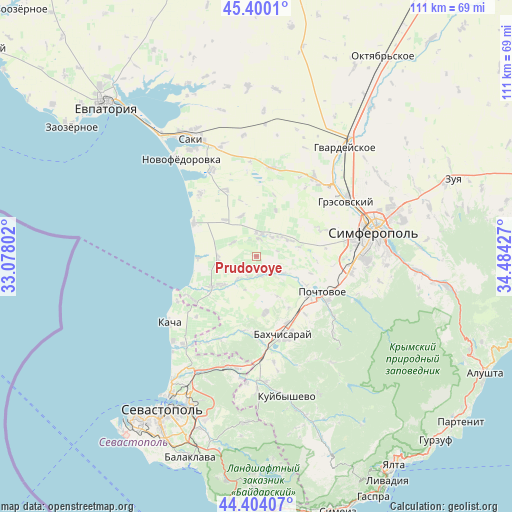
44° 54' 15.264" North, 33° 46' 52.104" East
| Map corner | latitude | longitude |
|---|---|---|
| Upper-left | 45.4001°, | 33.07802° |
| Center: | 44.90424°, | 33.78114° |
| Lower-right: | 44.40407°, | 34.48427° |
| Map W x H: | 110.7×110.7 km | = 68.8×68.8mi |
| max Lat: | 52.18903° ⇑93.1% North |
| Prudovoye: | 44.90424° |
| min Lat: | ⇓6.9% South 44.39214° |
| min Long | Prudovoye | max Long |
| 22.20555° | 33.78114° | 40.13222° |
| W 57.2%⇐ | ⇒42.8% E |
Elevation
Elevation of Prudovoye is 122 m = 400 ft, and this is 33.8 m = 111 ft below average elevation for this country.
| Max E: |
886 m = 2907 ft | 54% |
| Avg. | 155.8 m = 511 ft | |
| Prudovoye | 122 m = 400 ft | |
Min E: |
-3 m = -10 ft | 46% |
See also: Ukraine elevation on elevation.city.
Geographical zone
Prudovoye is located in North temperate zone (between Tropic of Cancer and the Arctic Circle). Distance of this Northern Tropic circle is 2387 km =1483.2 mi to South.| Distance of | km | miles | from Prudovoye |
|---|---|---|---|
| North Pole | 5014.2 | 3115.7 | to North |
| Arctic Circle | 2408.3 | 1496.4 | to North |
| Tropic Cancer | 2387 | 1483.2 | to South |
| Equator | 4992.9 | 3102.4 | to South |


Nearby cities:
15 places around Prudovoye: (largest is in red/bold)
• Bryanskoye
4.6 km =2.9 mi,  156°
156°
• Kashtany
4.1 km =2.5 mi,  170°
170°
• Kol’chugino
4.4 km =2.7 mi,  7°
7°
• Lekarstvennoye
5.3 km =3.3 mi,  37°
37°
• Novosyolovka
10.8 km =6.7 mi,  23°
23°
• Otradnoye
6.2 km =3.9 mi,  219°
219°
• Plodovoye
6.9 km =4.3 mi,  121°
121°
• Pozharskoye
7.9 km =4.9 mi,  63°
63°
• Ravnopolye
5.9 km =3.7 mi,  299°
299°
• Razdolye
10.4 km =6.5 mi,  318°
318°
• Shevchenkovo
4.9 km =3 mi,  200°
200°
• Tabachnoye
8.3 km =5.2 mi,  268°
268°
• Vilino
10.8 km =6.7 mi,  232°
232°
• Vinnitskoye
9.2 km =5.7 mi,  338°
338°
• Vodnoye
6.5 km =4 mi,  51°
51°
Sources, notices
• [Note1] Compared only with cities in Ukraine existing in our database
• [Src1] Map data: © OpenStreetMap contributors (CC-BY-SA)
• [Src2] Other city data from geonames.org with taken over terms of usage.
• [Src3] Geographical zone / Annual Mean Temperature by Robert A. Rohde @ Wikipedia
