Ravnopolye geodata
Ravnopolye (Republic of Crimea) is a populated place; located in Ukraine in Europe/Simferopol (GMT+3) time zone. With population of 924 people, there are 1419 cities with bigger population in this country. Compared to other cities in Ukraine, 92.8% of cities are located further ↑North; 55.9% of cities are located further ←West and 78.1% of cities have higher elevation than Ravnopolye. Note1
Administrative division(s):
- Level 1: Republic of Crimea
- Level 2: Simferopol Raion
- Level 3: Kol'chuginskoye sel'skoye poselenye


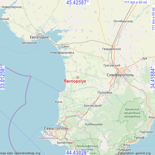
Ravnopolye GPS coordinates[2]
44° 55' 48.864" North, 33° 42' 56.556" East
| Map corner | latitude | longitude |
|---|---|---|
| Upper-left | 45.42587°, | 33.01259° |
| Center: | 44.93024°, | 33.71571° |
| Lower-right: | 44.43029°, | 34.41884° |
| Map W x H: | 110.7×110.7 km | = 68.8×68.8mi |
| max Lat: | 52.18903° ⇑92.8% North |
| Ravnopolye: | 44.93024° |
| min Lat: | ⇓7.2% South 44.39214° |
| min Long | Ravnopolye | max Long |
| 22.20555° | 33.71571° | 40.13222° |
| W 55.9%⇐ | ⇒44.1% E |
Elevation
Elevation of Ravnopolye is 50 m = 164 ft, and this is 105.8 m = 347 ft below average elevation for this country.
| Max E: |
886 m = 2907 ft | 78.1% |
| Avg. | 155.8 m = 511 ft | |
| Ravnopolye | 50 m = 164 ft | |
Min E: |
-3 m = -10 ft | 21.9% |
See also: Ukraine elevation on elevation.city.
Geographical zone
Ravnopolye is located in North temperate zone (between Tropic of Cancer and the Arctic Circle). Distance of this Northern Tropic circle is 2389.9 km =1485 mi to South.| Distance of | km | miles | from Ravnopolye |
|---|---|---|---|
| North Pole | 5011.3 | 3113.9 | to North |
| Arctic Circle | 2405.4 | 1494.6 | to North |
| Tropic Cancer | 2389.9 | 1485 | to South |
| Equator | 4995.8 | 3104.2 | to South |


Nearby cities:
15 places around Ravnopolye: (largest is in red/bold)
• Beregovoye
8.5 km =5.3 mi,  246°
246°
• Bryanskoye
10 km =6.2 mi,  135°
135°
• Kashtany
9.1 km =5.7 mi, 139°
• Kol’chugino
5.9 km =3.7 mi,  75°
75°
• Lekarstvennoye
8.5 km =5.3 mi, 81°
• Nikolayevka
9 km =5.6 mi,  293°
293°
• Otradnoye
7.8 km =4.8 mi,  171°
171°
• Prudovoye
5.9 km =3.7 mi,  119°
119°
• Razdolye
5.2 km =3.2 mi,  341°
341°
• Shevchenkovo
8.2 km =5.1 mi,  155°
155°
• Tabachnoye
4.4 km =2.7 mi,  224°
224°
• Teplovka
11.5 km =7.1 mi,  352°
352°
• Vilino
10 km =6.2 mi,  200°
200°
• Vinnitskoye
6 km =3.7 mi,  18°
18°
• Vodnoye
10.3 km =6.4 mi, 83°
Sources, notices
• [Note1] Compared only with cities in Ukraine existing in our database
• [Src1] Map data: © OpenStreetMap contributors (CC-BY-SA)
• [Src2] Other city data from geonames.org with taken over terms of usage.
• [Src3] Geographical zone / Annual Mean Temperature by Robert A. Rohde @ Wikipedia
