Kashtany geodata
Kashtany (Republic of Crimea) is a seat of a third-order administrative division; located in Ukraine in Europe/Simferopol (GMT+3) time zone. With population of 862 people, there are 1455 cities with bigger population in this country. Compared to other cities in Ukraine, 94% of cities are located further ↑North; 57.7% of cities are located further ←West and 66.9% of cities have higher elevation than Kashtany. Note1
Administrative division(s):
- Level 1: Republic of Crimea
- Level 2: Bakhchysarai Raion
- Level 3: Kashtanovskoye sel'skoye poselenye


Kashtany GPS coordinates[2]
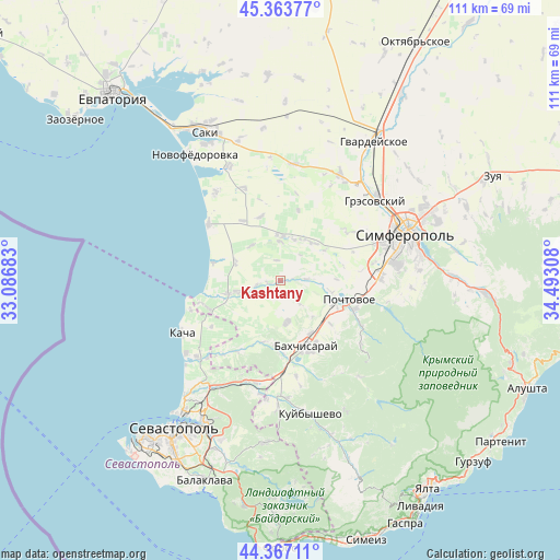
44° 52' 3.36" North, 33° 47' 23.82" East
| Map corner | latitude | longitude |
|---|---|---|
| Upper-left | 45.36377°, | 33.08683° |
| Center: | 44.8676°, | 33.78995° |
| Lower-right: | 44.36711°, | 34.49308° |
| Map W x H: | 110.8×110.8 km | = 68.8×68.8mi |
| max Lat: | 52.18903° ⇑94% North |
| Kashtany: | 44.8676° |
| min Lat: | ⇓6% South 44.39214° |
| min Long | Kashtany | max Long |
| 22.20555° | 33.78995° | 40.13222° |
| W 57.7%⇐ | ⇒42.3% E |
Elevation
Elevation of Kashtany is 84 m = 276 ft, and this is 71.8 m = 236 ft below average elevation for this country.
| Max E: |
886 m = 2907 ft | 66.9% |
| Avg. | 155.8 m = 511 ft | |
| Kashtany | 84 m = 276 ft | |
Min E: |
-3 m = -10 ft | 33.1% |
See also: Ukraine elevation on elevation.city.
Geographical zone
Kashtany is located in North temperate zone (between Tropic of Cancer and the Arctic Circle). Distance of this Northern Tropic circle is 2382.9 km =1480.7 mi to South.| Distance of | km | miles | from Kashtany |
|---|---|---|---|
| North Pole | 5018.3 | 3118.2 | to North |
| Arctic Circle | 2412.4 | 1499 | to North |
| Tropic Cancer | 2382.9 | 1480.7 | to South |
| Equator | 4988.8 | 3099.9 | to South |


Nearby cities:
15 places around Kashtany: (largest is in red/bold)
• Aromatnoye
9.5 km =5.9 mi,  138°
138°
• Bryanskoye
1.1 km =0.7 mi,  97°
97°
• Kol’chugino
8.5 km =5.3 mi,  359°
359°
• Lekarstvennoye
8.6 km =5.3 mi,  17°
17°
• Malovidnoye
8.1 km =5 mi,  169°
169°
• Otradnoye
4.7 km =2.9 mi,  261°
261°
• Plodovoye
5.2 km =3.2 mi,  85°
85°
• Pozharskoye
9.9 km =6.2 mi,  40°
40°
• Prudovoye
4.1 km =2.5 mi,  350°
350°
• Ravnopolye
9.1 km =5.7 mi,  319°
319°
• Shevchenkovo
2.5 km =1.6 mi, 257°
• Tabachnoye
9.7 km =6 mi,  292°
292°
• Viktorovka
8.5 km =5.3 mi, 172°
• Vilino
9.6 km =6 mi, 255°
• Vodnoye
9.2 km =5.7 mi,  28°
28°
Sources, notices
• [Note1] Compared only with cities in Ukraine existing in our database
• [Src1] Map data: © OpenStreetMap contributors (CC-BY-SA)
• [Src2] Other city data from geonames.org with taken over terms of usage.
• [Src3] Geographical zone / Annual Mean Temperature by Robert A. Rohde @ Wikipedia
