Prolisky geodata
Prolisky (Kyiv City) is a populated place; located in Ukraine in Europe/Kiev (GMT+3) time zone. With population of 1,852 people, there are 1137 cities with bigger population in this country. Compared to other cities in Ukraine, 89.6% of cities are located further ↓South; 63% of cities are located further →East and 51.4% of cities have higher elevation than Prolisky. Note1


Prolisky GPS coordinates[2]
50° 23' 28.248" North, 30° 46' 48" East
| Map corner | latitude | longitude |
|---|---|---|
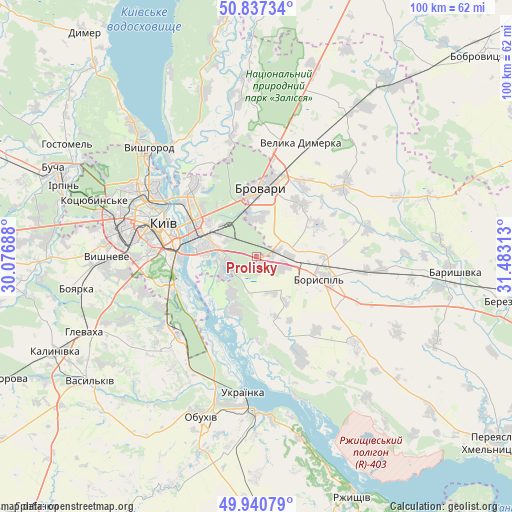
| Upper-left | 50.83734°, | 30.07688° |
| Center: | 50.39118°, | 30.78° |
| Lower-right: | 49.94079°, | 31.48313° |
| Map W x H: | 99.7×99.7 km | = 62×62mi |
| max Lat: | 52.18903° ⇑10.4% North |
| Prolisky: | 50.39118° |
| min Lat: | ⇓89.6% South 44.39214° |
| min Long | Prolisky | max Long |
| 22.20555° | 30.78° | 40.13222° |
| W 37%⇐ | ⇒63% E |
Elevation
Elevation of Prolisky is 129 m = 423 ft, and this is 26.8 m = 88 ft below average elevation for this country.
| Max E: |
886 m = 2907 ft | 51.4% |
| Avg. | 155.8 m = 511 ft | |
| Prolisky | 129 m = 423 ft | |
Min E: |
-3 m = -10 ft | 48.6% |
See also: Ukraine elevation on elevation.city.
Geographical zone
Prolisky is located in North temperate zone (between Tropic of Cancer and the Arctic Circle). Distance of this North polar circle is 1798.2 km =1117.3 mi to North.| Distance of | km | miles | from Prolisky |
|---|---|---|---|
| North Pole | 4404.1 | 2736.6 | to North |
| Arctic Circle | 1798.2 | 1117.3 | to North |
| Tropic Cancer | 2997.1 | 1862.3 | to South |
| Equator | 5603 | 3481.5 | to South |


Nearby cities:
15 places around Prolisky: (largest is in red/bold)
• Boryspil’
13.1 km =8.1 mi,  109°
109°
• Brovary
14.2 km =8.8 mi,  7°
7°
• Chabany
25.9 km =16.1 mi,  257°
257°
• Hnidyn
8.5 km =5.3 mi,  215°
215°
• Khotiv
23.1 km =14.4 mi,  253°
253°
• Khotyanivka
27.2 km =16.9 mi,  327°
327°
• Kirove
24.3 km =15.1 mi,  95°
95°
• Knyazhichi
8 km =5 mi,  1°
1°
• Kyiv
19.5 km =12.1 mi,  291°
291°
• Pohreby
20.5 km =12.7 mi, 332°
• Pukhivka
24.7 km =15.3 mi,  349°
349°
• Trebukhiv
13.5 km =8.4 mi,  40°
40°
• Ukrainka
27.7 km =17.2 mi,  184°
184°
• Velyka Dymerka
24.1 km =15 mi,  21°
21°
• Voronkov
20.6 km =12.8 mi,  155°
155°
Sources, notices
• [Note1] Compared only with cities in Ukraine existing in our database
• [Src1] Map data: © OpenStreetMap contributors (CC-BY-SA)
• [Src2] Other city data from geonames.org with taken over terms of usage.
• [Src3] Geographical zone / Annual Mean Temperature by Robert A. Rohde @ Wikipedia
