Velyka Dymerka geodata
Velyka Dymerka (Kyiv) is a populated place; located in Ukraine in Europe/Kiev (GMT+3) time zone. With population of 9,606 people, there are 372 cities with bigger population in this country. Compared to other cities in Ukraine, 92.1% of cities are located further ↓South; 61.9% of cities are located further →East and 54% of cities have higher elevation than Velyka Dymerka. Note1


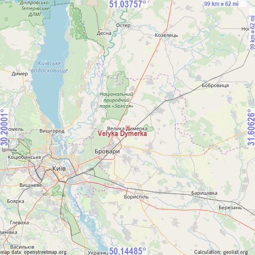
Velyka Dymerka GPS coordinates[2]
50° 35' 35.988" North, 30° 54' 11.268" East
| Map corner | latitude | longitude |
|---|---|---|
| Upper-left | 51.03757°, | 30.20001° |
| Center: | 50.59333°, | 30.90313° |
| Lower-right: | 50.14485°, | 31.60626° |
| Map W x H: | 99.3×99.3 km | = 61.7×61.7mi |
| max Lat: | 52.18903° ⇑7.9% North |
| Velyka Dymerka: | 50.59333° |
| min Lat: | ⇓92.1% South 44.39214° |
| min Long | Velyka Dymerka | max Long |
| 22.20555° | 30.90313° | 40.13222° |
| W 38.1%⇐ | ⇒61.9% E |
Elevation
Elevation of Velyka Dymerka is 122 m = 400 ft, and this is 33.8 m = 111 ft below average elevation for this country.
| Max E: |
886 m = 2907 ft | 54% |
| Avg. | 155.8 m = 511 ft | |
| Velyka Dymerka | 122 m = 400 ft | |
Min E: |
-3 m = -10 ft | 46% |
See also: Ukraine elevation on elevation.city.
Geographical zone
Velyka Dymerka is located in North temperate zone (between Tropic of Cancer and the Arctic Circle). Distance of this North polar circle is 1775.7 km =1103.4 mi to North.| Distance of | km | miles | from Velyka Dymerka |
|---|---|---|---|
| North Pole | 4381.6 | 2722.6 | to North |
| Arctic Circle | 1775.7 | 1103.4 | to North |
| Tropic Cancer | 3019.5 | 1876.2 | to South |
| Equator | 5625.5 | 3495.5 | to South |


Nearby cities:
15 places around Velyka Dymerka: (largest is in red/bold)
• Boryspil’
27 km =16.8 mi,  172°
172°
• Brovary
10.8 km =6.7 mi,  219°
219°
• Hnidyn
32.4 km =20.1 mi,  204°
204°
• Khotyanivka
23.4 km =14.5 mi,  271°
271°
• Kirove
29.3 km =18.2 mi,  148°
148°
• Knyazhichi
16.8 km =10.4 mi,  210°
210°
• Kyiv
30.9 km =19.2 mi,  240°
240°
• Liutizh
37.3 km =23.2 mi,  285°
285°
• Novi Petrivtsi
32.7 km =20.3 mi,  276°
276°
• Pohreby
18.8 km =11.7 mi,  256°
256°
• Prolisky
24.1 km =15 mi, 201°
• Pukhivka
13.2 km =8.2 mi, 277°
• Semypolky
14.9 km =9.3 mi,  8°
8°
• Trebukhiv
12.1 km =7.5 mi,  180°
180°
• Vyshhorod
29.2 km =18.1 mi, 268°
Sources, notices
• [Note1] Compared only with cities in Ukraine existing in our database
• [Src1] Map data: © OpenStreetMap contributors (CC-BY-SA)
• [Src2] Other city data from geonames.org with taken over terms of usage.
• [Src3] Geographical zone / Annual Mean Temperature by Robert A. Rohde @ Wikipedia
