Boryspil’ geodata
Boryspil’ (Kyiv) is a seat of a second-order administrative division; located in Ukraine in Europe/Kiev (GMT+3) time zone. With population of 55,000 people, there are 85 cities with bigger population in this country. Compared to other cities in Ukraine, 88.7% of cities are located further ↓South; 61.5% of cities are located further →East and 57.7% of cities have higher elevation than Boryspil’. Note1


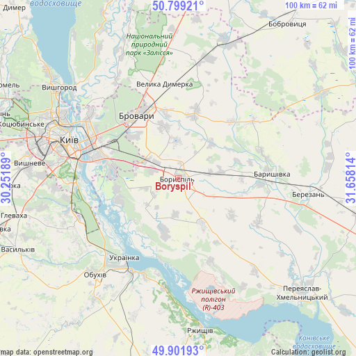
Boryspil’ GPS coordinates[2]
50° 21' 9.684" North, 30° 57' 18.036" East
| Map corner | latitude | longitude |
|---|---|---|
| Upper-left | 50.79921°, | 30.25189° |
| Center: | 50.35269°, | 30.95501° |
| Lower-right: | 49.90193°, | 31.65814° |
| Map W x H: | 99.8×99.8 km | = 62×62mi |
| max Lat: | 52.18903° ⇑11.3% North |
| Boryspil’: | 50.35269° |
| min Lat: | ⇓88.7% South 44.39214° |
| min Long | Boryspil’ | max Long |
| 22.20555° | 30.95501° | 40.13222° |
| W 38.5%⇐ | ⇒61.5% E |
Elevation
Elevation of Boryspil’ is 113 m = 371 ft, and this is 42.8 m = 140 ft below average elevation for this country.
| Max E: |
886 m = 2907 ft | 57.7% |
| Avg. | 155.8 m = 511 ft | |
| Boryspil’ | 113 m = 371 ft | |
Min E: |
-3 m = -10 ft | 42.3% |
See also: Boryspil’ elevation on elevation.city.
Geographical zone
Boryspil’ is located in North temperate zone (between Tropic of Cancer and the Arctic Circle). Distance of this North polar circle is 1802.5 km =1120 mi to North.| Distance of | km | miles | from Boryspil’ |
|---|---|---|---|
| North Pole | 4408.4 | 2739.3 | to North |
| Arctic Circle | 1802.5 | 1120 | to North |
| Tropic Cancer | 2992.8 | 1859.6 | to South |
| Equator | 5598.7 | 3478.9 | to South |


Nearby cities:
15 places around Boryspil’: (largest is in red/bold)
• Baryshivka
26 km =16.2 mi,  87°
87°
• Brovary
21.2 km =13.2 mi,  330°
330°
• Hnidyn
17.5 km =10.9 mi,  261°
261°
• Kirove
11.9 km =7.4 mi,  81°
81°
• Knyazhichi
17.2 km =10.7 mi,  315°
315°
• Kyiv
32.6 km =20.3 mi,  290°
290°
• Pohreby
31.4 km =19.5 mi, 315°
• Prolisky
13.1 km =8.1 mi, 289°
• Stayki
30.7 km =19.1 mi,  186°
186°
• Trebukhiv
15.1 km =9.4 mi,  345°
345°
• Trypillia
28.9 km =18 mi,  205°
205°
• Ukrainka
27.6 km =17.1 mi, 212°
• Velyka Dymerka
27 km =16.8 mi, 352°
• Voronkov
15 km =9.3 mi,  195°
195°
• Vytachiv
27.2 km =16.9 mi, 192°
Sources, notices
• [Note1] Compared only with cities in Ukraine existing in our database
• [Src1] Map data: © OpenStreetMap contributors (CC-BY-SA)
• [Src2] Other city data from geonames.org with taken over terms of usage.
• [Src3] Geographical zone / Annual Mean Temperature by Robert A. Rohde @ Wikipedia
