Zaliznyy Port geodata
Zaliznyy Port (Kherson) is a populated place; located in Ukraine in Europe/Kiev (GMT+3) time zone. With population of 1,528 people, there are 1204 cities with bigger population in this country. Compared to other cities in Ukraine, 69.1% of cities are located further ↑North; 56.2% of cities are located further →East and 99% of cities have higher elevation than Zaliznyy Port. Note1


Zaliznyy Port GPS coordinates[2]
46° 7' 24.132" North, 32° 17' 56.112" East
| Map corner | latitude | longitude |
|---|---|---|
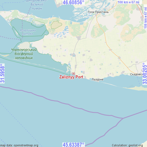
| Upper-left | 46.60856°, | 31.5958° |
| Center: | 46.12337°, | 32.29892° |
| Lower-right: | 45.63387°, | 33.00205° |
| Map W x H: | 108.4×108.4 km | = 67.4×67.4mi |
| max Lat: | 52.18903° ⇑69.1% North |
| Zaliznyy Port: | 46.12337° |
| min Lat: | ⇓30.9% South 44.39214° |
| min Long | Zaliznyy Port | max Long |
| 22.20555° | 32.29892° | 40.13222° |
| W 43.8%⇐ | ⇒56.2% E |
Elevation
Elevation of Zaliznyy Port is 5 m = 16 ft, and this is 150.8 m = 495 ft below average elevation for this country.
| Max E: |
886 m = 2907 ft | 99% |
| Avg. | 155.8 m = 511 ft | |
| Zaliznyy Port | 5 m = 16 ft | |
Min E: |
-3 m = -10 ft | 1% |
See also: Ukraine elevation on elevation.city.
Geographical zone
Zaliznyy Port is located in North temperate zone (between Tropic of Cancer and the Arctic Circle). Distance of this North polar circle is 2272.7 km =1412.2 mi to North.| Distance of | km | miles | from Zaliznyy Port |
|---|---|---|---|
| North Pole | 4878.6 | 3031.4 | to North |
| Arctic Circle | 2272.7 | 1412.2 | to North |
| Tropic Cancer | 2522.5 | 1567.4 | to South |
| Equator | 5128.4 | 3186.6 | to South |


Nearby cities:
15 places around Zaliznyy Port: (largest is in red/bold)
• Bekhtery
13.9 km =8.6 mi,  357°
357°
• Bilozerka
56.8 km =35.3 mi,  11°
11°
• Chulakivka
26.4 km =16.4 mi, 8°
• Hola Prystan’
48.1 km =29.9 mi,  21°
21°
• Kherson
64.1 km =39.8 mi, 22°
• Komyshany
59.3 km =36.8 mi, 15°
• Krasne
36.2 km =22.5 mi,  88°
88°
• Lazurne
18.3 km =11.4 mi,  103°
103°
• Novofedorivka
5.5 km =3.4 mi, 15°
• Skadovs’k
47.2 km =29.3 mi, 90°
• Stanislav
50.9 km =31.6 mi,  346°
346°
• Tsyurupyns’k
63.8 km =39.6 mi,  30°
30°
• Velyki Kopani
65.8 km =40.9 mi,  52°
52°
• Vynohradove
56.4 km =35 mi,  60°
60°
• Геройское
53.3 km =33.1 mi,  323°
323°
Sources, notices
• [Note1] Compared only with cities in Ukraine existing in our database
• [Src1] Map data: © OpenStreetMap contributors (CC-BY-SA)
• [Src2] Other city data from geonames.org with taken over terms of usage.
• [Src3] Geographical zone / Annual Mean Temperature by Robert A. Rohde @ Wikipedia
