Yarkoye geodata
Yarkoye (Republic of Crimea) is a populated place; located in Ukraine in Europe/Simferopol (GMT+3) time zone. With population of 568 people, there are 1606 cities with bigger population in this country. Compared to other cities in Ukraine, 86.6% of cities are located further ↑North; 58.2% of cities are located further ←West and 70.3% of cities have higher elevation than Yarkoye. Note1
Administrative division(s):
- Level 1: Republic of Crimea
- Level 2: Sakskiy rayon
- Level 3: Geroyskoye sel'skoye poselenye


Yarkoye GPS coordinates[2]
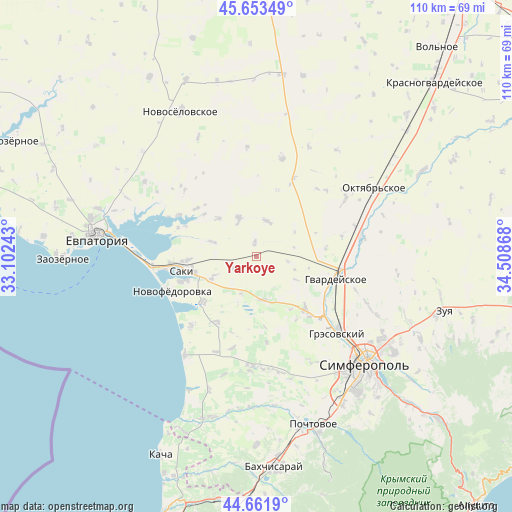
45° 9' 35.46" North, 33° 48' 19.98" East
| Map corner | latitude | longitude |
|---|---|---|
| Upper-left | 45.65349°, | 33.10243° |
| Center: | 45.15985°, | 33.80555° |
| Lower-right: | 44.6619°, | 34.50868° |
| Map W x H: | 110.3×110.3 km | = 68.5×68.5mi |
| max Lat: | 52.18903° ⇑86.6% North |
| Yarkoye: | 45.15985° |
| min Lat: | ⇓13.4% South 44.39214° |
| min Long | Yarkoye | max Long |
| 22.20555° | 33.80555° | 40.13222° |
| W 58.2%⇐ | ⇒41.8% E |
Elevation
Elevation of Yarkoye is 74 m = 243 ft, and this is 81.8 m = 268 ft below average elevation for this country.
| Max E: |
886 m = 2907 ft | 70.3% |
| Avg. | 155.8 m = 511 ft | |
| Yarkoye | 74 m = 243 ft | |
Min E: |
-3 m = -10 ft | 29.7% |
See also: Ukraine elevation on elevation.city.
Geographical zone
Yarkoye is located in North temperate zone (between Tropic of Cancer and the Arctic Circle). Distance of this North polar circle is 2379.9 km =1478.8 mi to North.| Distance of | km | miles | from Yarkoye |
|---|---|---|---|
| North Pole | 4985.8 | 3098 | to North |
| Arctic Circle | 2379.9 | 1478.8 | to North |
| Tropic Cancer | 2415.4 | 1500.9 | to South |
| Equator | 5021.3 | 3120.1 | to South |


Nearby cities:
15 places around Yarkoye: (largest is in red/bold)
• Chervonoye
10.2 km =6.3 mi,  246°
246°
• Dolinka
14.4 km =8.9 mi,  309°
309°
• Geroyskoye
5.2 km =3.2 mi,  242°
242°
• Ivanovka
15 km =9.3 mi,  229°
229°
• Krayneye
8.1 km =5 mi,  15°
15°
• Krymskoye
3.2 km =2 mi,  353°
353°
• Kurgannoye
14.6 km =9.1 mi,  133°
133°
• Lesnovka
14.7 km =9.1 mi,  267°
267°
• Mityayevo
11.6 km =7.2 mi,  315°
315°
• Orekhovo
14 km =8.7 mi,  256°
256°
• Shelkovichnoye
9.7 km =6 mi,  288°
288°
• Shkol’noye
13.5 km =8.4 mi,  147°
147°
• Skvortsovo
9.5 km =5.9 mi,  172°
172°
• Trudovoye
9.4 km =5.8 mi,  336°
336°
• Zernovoye
15 km =9.3 mi, 17°
Sources, notices
• [Note1] Compared only with cities in Ukraine existing in our database
• [Src1] Map data: © OpenStreetMap contributors (CC-BY-SA)
• [Src2] Other city data from geonames.org with taken over terms of usage.
• [Src3] Geographical zone / Annual Mean Temperature by Robert A. Rohde @ Wikipedia
