Trudovoye geodata
Trudovoye (Republic of Crimea) is a populated place; located in Ukraine in Europe/Simferopol (GMT+3) time zone. With population of 1,423 people, there are 1233 cities with bigger population in this country. Compared to other cities in Ukraine, 84.8% of cities are located further ↑North; 56.6% of cities are located further ←West and 87.6% of cities have higher elevation than Trudovoye. Note1
Administrative division(s):
- Level 1: Republic of Crimea
- Level 2: Sakskiy rayon
- Level 3: Kraynenskoye sel'skoye poselenye


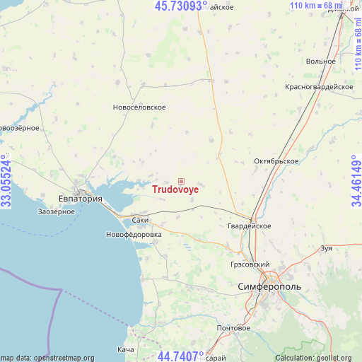
Trudovoye GPS coordinates[2]
45° 14' 16.692" North, 33° 45' 30.096" East
| Map corner | latitude | longitude |
|---|---|---|
| Upper-left | 45.73093°, | 33.05524° |
| Center: | 45.23797°, | 33.75836° |
| Lower-right: | 44.7407°, | 34.46149° |
| Map W x H: | 110.1×110.1 km | = 68.4×68.4mi |
| max Lat: | 52.18903° ⇑84.8% North |
| Trudovoye: | 45.23797° |
| min Lat: | ⇓15.2% South 44.39214° |
| min Long | Trudovoye | max Long |
| 22.20555° | 33.75836° | 40.13222° |
| W 56.6%⇐ | ⇒43.4% E |
Elevation
Elevation of Trudovoye is 23 m = 75 ft, and this is 132.8 m = 436 ft below average elevation for this country.
| Max E: |
886 m = 2907 ft | 87.6% |
| Avg. | 155.8 m = 511 ft | |
| Trudovoye | 23 m = 75 ft | |
Min E: |
-3 m = -10 ft | 12.4% |
See also: Ukraine elevation on elevation.city.
Geographical zone
Trudovoye is located in North temperate zone (between Tropic of Cancer and the Arctic Circle). Distance of this North polar circle is 2371.2 km =1473.4 mi to North.| Distance of | km | miles | from Trudovoye |
|---|---|---|---|
| North Pole | 4977.1 | 3092.6 | to North |
| Arctic Circle | 2371.2 | 1473.4 | to North |
| Tropic Cancer | 2424.1 | 1506.3 | to South |
| Equator | 5030 | 3125.5 | to South |


Nearby cities:
15 places around Trudovoye: (largest is in red/bold)
• Chervonoye
14 km =8.7 mi,  203°
203°
• Dolinka
7.4 km =4.6 mi,  273°
273°
• Geroyskoye
11.1 km =6.9 mi,  184°
184°
• Il’inka
15.1 km =9.4 mi,  6°
6°
• Kar’yernoye
12.9 km =8 mi,  295°
295°
• Krayneye
5.9 km =3.7 mi,  98°
98°
• Krymskoye
6.5 km =4 mi,  148°
148°
• Lesnovka
14.4 km =8.9 mi,  229°
229°
• Mityayevo
4.5 km =2.8 mi,  264°
264°
• Okhotnikovo
12.9 km =8 mi, 270°
• Orlyanka
15.1 km =9.4 mi, 269°
• Shelkovichnoye
7.9 km =4.9 mi,  224°
224°
• Yarkoye
9.4 km =5.8 mi,  156°
156°
• Zernovoye
10 km =6.2 mi,  55°
55°
• Zhuravli
9.3 km =5.8 mi,  279°
279°
Sources, notices
• [Note1] Compared only with cities in Ukraine existing in our database
• [Src1] Map data: © OpenStreetMap contributors (CC-BY-SA)
• [Src2] Other city data from geonames.org with taken over terms of usage.
• [Src3] Geographical zone / Annual Mean Temperature by Robert A. Rohde @ Wikipedia
