Krymskoye geodata
Krymskoye (Republic of Crimea) is a seat of a third-order administrative division; located in Ukraine in Europe/Simferopol (GMT+3) time zone. With population of 1,822 people, there are 1144 cities with bigger population in this country. Compared to other cities in Ukraine, 86.1% of cities are located further ↑North; 58% of cities are located further ←West and 72.2% of cities have higher elevation than Krymskoye. Note1
Administrative division(s):
- Level 1: Republic of Crimea
- Level 2: Sakskiy rayon
- Level 3: Krymskoye sel'skoye poselenye


Krymskoye GPS coordinates[2]
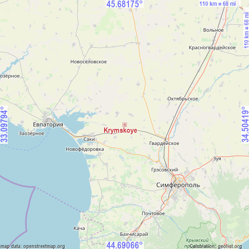
45° 11' 18.096" North, 33° 48' 3.816" East
| Map corner | latitude | longitude |
|---|---|---|
| Upper-left | 45.68175°, | 33.09794° |
| Center: | 45.18836°, | 33.80106° |
| Lower-right: | 44.69066°, | 34.50419° |
| Map W x H: | 110.2×110.2 km | = 68.5×68.5mi |
| max Lat: | 52.18903° ⇑86.1% North |
| Krymskoye: | 45.18836° |
| min Lat: | ⇓13.9% South 44.39214° |
| min Long | Krymskoye | max Long |
| 22.20555° | 33.80106° | 40.13222° |
| W 58%⇐ | ⇒42% E |
Elevation
Elevation of Krymskoye is 69 m = 226 ft, and this is 86.8 m = 285 ft below average elevation for this country.
| Max E: |
886 m = 2907 ft | 72.2% |
| Avg. | 155.8 m = 511 ft | |
| Krymskoye | 69 m = 226 ft | |
Min E: |
-3 m = -10 ft | 27.8% |
See also: Ukraine elevation on elevation.city.
Geographical zone
Krymskoye is located in North temperate zone (between Tropic of Cancer and the Arctic Circle). Distance of this North polar circle is 2376.7 km =1476.8 mi to North.| Distance of | km | miles | from Krymskoye |
|---|---|---|---|
| North Pole | 4982.6 | 3096 | to North |
| Arctic Circle | 2376.7 | 1476.8 | to North |
| Tropic Cancer | 2418.6 | 1502.8 | to South |
| Equator | 5024.5 | 3122.1 | to South |


Nearby cities:
15 places around Krymskoye: (largest is in red/bold)
• Chervonoye
11.6 km =7.2 mi,  230°
230°
• Dolinka
12.3 km =7.6 mi,  299°
299°
• Geroyskoye
7 km =4.3 mi,  217°
217°
• Krayneye
5.2 km =3.2 mi,  27°
27°
• Lesnovka
14.8 km =9.2 mi,  254°
254°
• Mityayevo
9.3 km =5.8 mi, 303°
• Orekhovo
14.8 km =9.2 mi,  243°
243°
• Shelkovichnoye
8.9 km =5.5 mi,  269°
269°
• Shkol’noye
16.4 km =10.2 mi,  152°
152°
• Skvortsovo
12.7 km =7.9 mi,  172°
172°
• Trudovoye
6.5 km =4 mi,  328°
328°
• Yarkoye
3.2 km =2 mi, 173°
• Zernovoye
12.2 km =7.6 mi,  23°
23°
• Zhuravli
14.4 km =8.9 mi, 299°
• Zhuravlyovka
15.4 km =9.6 mi,  94°
94°
Sources, notices
• [Note1] Compared only with cities in Ukraine existing in our database
• [Src1] Map data: © OpenStreetMap contributors (CC-BY-SA)
• [Src2] Other city data from geonames.org with taken over terms of usage.
• [Src3] Geographical zone / Annual Mean Temperature by Robert A. Rohde @ Wikipedia
