Vytachiv geodata
Vytachiv (Kyiv) is a populated place; located in Ukraine in Europe/Kiev (GMT+3) time zone. With population of 816 people, there are 1477 cities with bigger population in this country. Compared to other cities in Ukraine, 85.4% of cities are located further ↓South; 62.3% of cities are located further →East and 51.9% of cities have lower elevation than Vytachiv. Note1


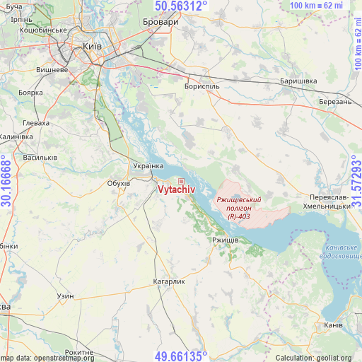
Vytachiv GPS coordinates[2]
50° 6' 51.696" North, 30° 52' 11.28" East
| Map corner | latitude | longitude |
|---|---|---|
| Upper-left | 50.56312°, | 30.16668° |
| Center: | 50.11436°, | 30.8698° |
| Lower-right: | 49.66135°, | 31.57293° |
| Map W x H: | 100.3×100.3 km | = 62.3×62.3mi |
| max Lat: | 52.18903° ⇑14.6% North |
| Vytachiv: | 50.11436° |
| min Lat: | ⇓85.4% South 44.39214° |
| min Long | Vytachiv | max Long |
| 22.20555° | 30.8698° | 40.13222° |
| W 37.7%⇐ | ⇒62.3% E |
Elevation
Elevation of Vytachiv is 141 m = 463 ft, and this is 14.8 m = 49 ft below average elevation for this country.
| Max E: |
886 m = 2907 ft | 48.1% |
| Avg. | 155.8 m = 511 ft | |
| Vytachiv | 141 m = 463 ft | |
Min E: |
-3 m = -10 ft | 51.9% |
See also: Ukraine elevation on elevation.city.
Geographical zone
Vytachiv is located in North temperate zone (between Tropic of Cancer and the Arctic Circle). Distance of this North polar circle is 1829 km =1136.5 mi to North.| Distance of | km | miles | from Vytachiv |
|---|---|---|---|
| North Pole | 4434.9 | 2755.7 | to North |
| Arctic Circle | 1829 | 1136.5 | to North |
| Tropic Cancer | 2966.3 | 1843.2 | to South |
| Equator | 5572.2 | 3462.4 | to South |


Nearby cities:
15 places around Vytachiv: (largest is in red/bold)
• Boryspil’
27.2 km =16.9 mi,  12°
12°
• Hnidyn
26.4 km =16.4 mi,  334°
334°
• Kaharlyk
28.2 km =17.5 mi,  186°
186°
• Khotiv
37.3 km =23.2 mi,  310°
310°
• Kirove
33.5 km =20.8 mi,  32°
32°
• Knyazhichi
39.2 km =24.4 mi,  351°
351°
• Mirovka
26.9 km =16.7 mi,  220°
220°
• Obukhiv
17.9 km =11.1 mi,  267°
267°
• Prolisky
31.4 km =19.5 mi, 348°
• Rzhyshchiv
20.5 km =12.7 mi,  142°
142°
• Stayki
4.7 km =2.9 mi,  148°
148°
• Trypillia
6.3 km =3.9 mi, 273°
• Ukrainka
9.4 km =5.8 mi,  289°
289°
• Vasylkiv
40.5 km =25.2 mi,  281°
281°
• Voronkov
12.2 km =7.6 mi, 10°
Sources, notices
• [Note1] Compared only with cities in Ukraine existing in our database
• [Src1] Map data: © OpenStreetMap contributors (CC-BY-SA)
• [Src2] Other city data from geonames.org with taken over terms of usage.
• [Src3] Geographical zone / Annual Mean Temperature by Robert A. Rohde @ Wikipedia
