Kaharlyk geodata
Kaharlyk (Kyiv) is a seat of a second-order administrative division; located in Ukraine in Europe/Kiev (GMT+3) time zone. With population of 13,245 people, there are 280 cities with bigger population in this country. Compared to other cities in Ukraine, 81% of cities are located further ↓South; 62.5% of cities are located further →East and 57.2% of cities have lower elevation than Kaharlyk. Note1


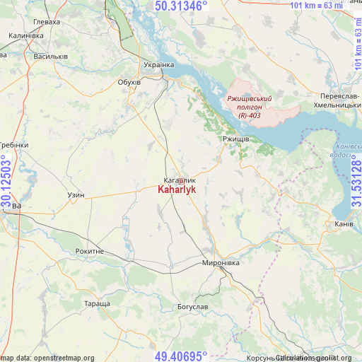
Kaharlyk GPS coordinates[2]
49° 51' 44.388" North, 30° 49' 41.34" East
| Map corner | latitude | longitude |
|---|---|---|
| Upper-left | 50.31346°, | 30.12503° |
| Center: | 49.86233°, | 30.82815° |
| Lower-right: | 49.40695°, | 31.53128° |
| Map W x H: | 100.8×100.8 km | = 62.6×62.6mi |
| max Lat: | 52.18903° ⇑19% North |
| Kaharlyk: | 49.86233° |
| min Lat: | ⇓81% South 44.39214° |
| min Long | Kaharlyk | max Long |
| 22.20555° | 30.82815° | 40.13222° |
| W 37.5%⇐ | ⇒62.5% E |
Elevation
Elevation of Kaharlyk is 159 m = 522 ft, and this is 3.2 m = 10 ft above average elevation for this country.
| Max E: |
886 m = 2907 ft | 42.8% |
| Kaharlyk | 159 m 522 ft | |
| Avg. | 155.8 m = 511 ft | |
Min E: |
-3 m = -10 ft | 57.2% |
See also: Ukraine elevation on elevation.city.
Geographical zone
Kaharlyk is located in North temperate zone (between Tropic of Cancer and the Arctic Circle). Distance of this North polar circle is 1857 km =1153.9 mi to North.| Distance of | km | miles | from Kaharlyk |
|---|---|---|---|
| North Pole | 4462.9 | 2773.1 | to North |
| Arctic Circle | 1857 | 1153.9 | to North |
| Tropic Cancer | 2938.3 | 1825.8 | to South |
| Equator | 5544.2 | 3445 | to South |


Nearby cities:
15 places around Kaharlyk: (largest is in red/bold)
• Bohuslav
35 km =21.7 mi,  174°
174°
• Kaniv
47 km =29.2 mi,  105°
105°
• Karapyshi
24.6 km =15.3 mi,  186°
186°
• Mirovka
16.6 km =10.3 mi,  297°
297°
• Myronivka
25.1 km =15.6 mi,  153°
153°
• Obukhiv
31.1 km =19.3 mi,  331°
331°
• Rokytne
32.1 km =19.9 mi,  232°
232°
• Rzhyshchiv
19.6 km =12.2 mi,  52°
52°
• Stayki
24.6 km =15.3 mi,  12°
12°
• Tarashcha
41.5 km =25.8 mi,  215°
215°
• Trypillia
28.6 km =17.8 mi,  353°
353°
• Ukrainka
31.8 km =19.8 mi, 349°
• Uzyn
29.9 km =18.6 mi,  262°
262°
• Voronkov
40.4 km =25.1 mi, 7°
• Vytachiv
28.2 km =17.5 mi, 6°
Sources, notices
• [Note1] Compared only with cities in Ukraine existing in our database
• [Src1] Map data: © OpenStreetMap contributors (CC-BY-SA)
• [Src2] Other city data from geonames.org with taken over terms of usage.
• [Src3] Geographical zone / Annual Mean Temperature by Robert A. Rohde @ Wikipedia
