Ordzhonikidze geodata
Ordzhonikidze (Dnipropetrovsk) is a seat of a second-order administrative division; located in Ukraine in Europe/Kiev (GMT+3) time zone. In our database, there are 1661 cities with bigger population. Compared to other cities in Ukraine, 59.4% of cities are located further ↑North; 64.5% of cities are located further ←West and 80.6% of cities have higher elevation than Ordzhonikidze. Note1


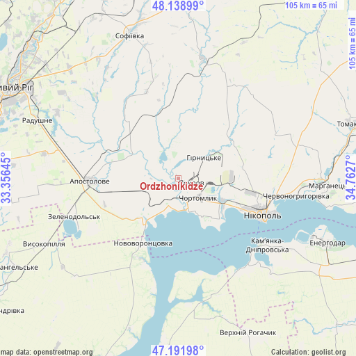
Ordzhonikidze GPS coordinates[2]
47° 40' 3.468" North, 34° 3' 34.452" East
| Map corner | latitude | longitude |
|---|---|---|
| Upper-left | 48.13899°, | 33.35645° |
| Center: | 47.66763°, | 34.05957° |
| Lower-right: | 47.19198°, | 34.7627° |
| Map W x H: | 105.3×105.3 km | = 65.4×65.4mi |
| max Lat: | 52.18903° ⇑59.4% North |
| Ordzhonikidze: | 47.66763° |
| min Lat: | ⇓40.6% South 44.39214° |
| min Long | Ordzhonikidze | max Long |
| 22.20555° | 34.05957° | 40.13222° |
| W 64.5%⇐ | ⇒35.5% E |
Elevation
Elevation of Ordzhonikidze is 41 m = 135 ft, and this is 114.8 m = 377 ft below average elevation for this country.
| Max E: |
886 m = 2907 ft | 80.6% |
| Avg. | 155.8 m = 511 ft | |
| Ordzhonikidze | 41 m = 135 ft | |
Min E: |
-3 m = -10 ft | 19.4% |
See also: Ukraine elevation on elevation.city.
Geographical zone
Ordzhonikidze is located in North temperate zone (between Tropic of Cancer and the Arctic Circle). Distance of this North polar circle is 2101 km =1305.5 mi to North.| Distance of | km | miles | from Ordzhonikidze |
|---|---|---|---|
| North Pole | 4706.9 | 2924.7 | to North |
| Arctic Circle | 2101 | 1305.5 | to North |
| Tropic Cancer | 2694.2 | 1674.1 | to South |
| Equator | 5300.1 | 3293.3 | to South |


Nearby cities:
15 places around Ordzhonikidze: (largest is in red/bold)
• Apostolove
25.9 km =16.1 mi,  268°
268°
• Chervonohryhorivka
36.2 km =22.5 mi,  97°
97°
• Chortomlyk
7.9 km =4.9 mi,  128°
128°
• Dniprovka
49.6 km =30.8 mi,  122°
122°
• Energodar
48.6 km =30.2 mi,  112°
112°
• Kamenka-Na-Dnepre
33.3 km =20.7 mi, 127°
• Marhanets’
42.7 km =26.5 mi,  94°
94°
• Nikopol
27.4 km =17 mi, 113°
• Novovorontsovka
21.4 km =13.3 mi,  209°
209°
• Sholokhove
3.7 km =2.3 mi,  324°
324°
• Sofiyivka
44.5 km =27.7 mi,  342°
342°
• Tomakivka
53.6 km =33.3 mi,  72°
72°
• Verkhniy Rohachyk
50.9 km =31.6 mi,  155°
155°
• Vodyane
38.1 km =23.7 mi, 121°
• Vysokopillya
44.2 km =27.5 mi,  243°
243°
Sources, notices
• [Note1] Compared only with cities in Ukraine existing in our database
• [Src1] Map data: © OpenStreetMap contributors (CC-BY-SA)
• [Src2] Other city data from geonames.org with taken over terms of usage.
• [Src3] Geographical zone / Annual Mean Temperature by Robert A. Rohde @ Wikipedia
