Staryy Sambir geodata
Staryy Sambir (Lviv) is a seat of a second-order administrative division; located in Ukraine in Europe/Kiev (GMT+3) time zone. With population of 5,603 people, there are 598 cities with bigger population in this country. Compared to other cities in Ukraine, 73.7% of cities are located further ↓South; 98.2% of cities are located further →East and 94.1% of cities have lower elevation than Staryy Sambir. Note1


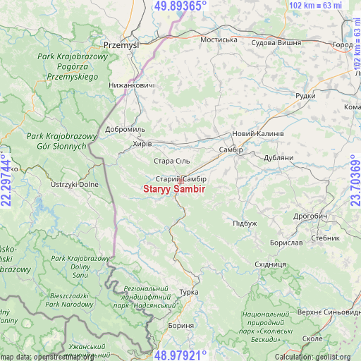
Staryy Sambir GPS coordinates[2]
49° 26' 18.816" North, 23° 0' 2.016" East
| Map corner | latitude | longitude |
|---|---|---|
| Upper-left | 49.89365°, | 22.29744° |
| Center: | 49.43856°, | 23.00056° |
| Lower-right: | 48.97921°, | 23.70369° |
| Map W x H: | 101.7×101.7 km | = 63.2×63.2mi |
| max Lat: | 52.18903° ⇑26.3% North |
| Staryy Sambir: | 49.43856° |
| min Lat: | ⇓73.7% South 44.39214° |
| min Long | Staryy Sambir | max Long |
| 22.20555° | 23.00056° | 40.13222° |
| W 1.8%⇐ | ⇒98.2% E |
Elevation
Elevation of Staryy Sambir is 348 m = 1142 ft, and this is 192.2 m = 631 ft above average elevation for this country.
| Max E: |
886 m = 2907 ft | 5.9% |
| Staryy Sambir | 348 m 1142 ft | |
| Avg. | 155.8 m = 511 ft | |
Min E: |
-3 m = -10 ft | 94.1% |
See also: Ukraine elevation on elevation.city.
Geographical zone
Staryy Sambir is located in North temperate zone (between Tropic of Cancer and the Arctic Circle). Distance of this North polar circle is 1904.1 km =1183.2 mi to North.| Distance of | km | miles | from Staryy Sambir |
|---|---|---|---|
| North Pole | 4510 | 2802.4 | to North |
| Arctic Circle | 1904.1 | 1183.2 | to North |
| Tropic Cancer | 2891.1 | 1796.4 | to South |
| Equator | 5497.1 | 3415.7 | to South |


Nearby cities:
15 places around Staryy Sambir: (largest is in red/bold)
• Boryslav
35.5 km =22.1 mi,  118°
118°
• Dobromyl’
21.4 km =13.3 mi,  313°
313°
• Drohobych
37.9 km =23.5 mi,  105°
105°
• Dublyany
28.7 km =17.8 mi,  76°
76°
• Khyriv
14.9 km =9.3 mi,  315°
315°
• Krukenychi
29.9 km =18.6 mi,  21°
21°
• Murovane
10.3 km =6.4 mi,  333°
333°
• Pidbuzh
21.4 km =13.3 mi, 122°
• Pnikut
31.9 km =19.8 mi, 18°
• Ralivka
18.4 km =11.4 mi,  68°
68°
• Sambir
16.8 km =10.4 mi,  58°
58°
• Skelivka
11.3 km =7 mi,  346°
346°
• Skhidnytsya
34.5 km =21.4 mi,  132°
132°
• Turka
31.7 km =19.7 mi,  176°
176°
• Voyutychi
14.7 km =9.1 mi,  31°
31°
Sources, notices
• [Note1] Compared only with cities in Ukraine existing in our database
• [Src1] Map data: © OpenStreetMap contributors (CC-BY-SA)
• [Src2] Other city data from geonames.org with taken over terms of usage.
• [Src3] Geographical zone / Annual Mean Temperature by Robert A. Rohde @ Wikipedia
