Shklo geodata
Shklo (Lviv) is a populated place; located in Ukraine in Europe/Kiev (GMT+3) time zone. With population of 5,164 people, there are 636 cities with bigger population in this country. Compared to other cities in Ukraine, 82.9% of cities are located further ↓South; 95.4% of cities are located further →East and 83.3% of cities have lower elevation than Shklo. Note1


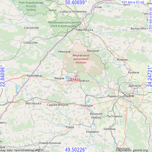
Shklo GPS coordinates[2]
49° 57' 24.3" North, 23° 32' 38.688" East
| Map corner | latitude | longitude |
|---|---|---|
| Upper-left | 50.40699°, | 22.84096° |
| Center: | 49.95675°, | 23.54408° |
| Lower-right: | 49.50226°, | 24.24721° |
| Map W x H: | 100.6×100.6 km | = 62.5×62.5mi |
| max Lat: | 52.18903° ⇑17.1% North |
| Shklo: | 49.95675° |
| min Lat: | ⇓82.9% South 44.39214° |
| min Long | Shklo | max Long |
| 22.20555° | 23.54408° | 40.13222° |
| W 4.6%⇐ | ⇒95.4% E |
Elevation
Elevation of Shklo is 265 m = 869 ft, and this is 109.2 m = 358 ft above average elevation for this country.
| Max E: |
886 m = 2907 ft | 16.7% |
| Shklo | 265 m 869 ft | |
| Avg. | 155.8 m = 511 ft | |
Min E: |
-3 m = -10 ft | 83.3% |
See also: Ukraine elevation on elevation.city.
Geographical zone
Shklo is located in North temperate zone (between Tropic of Cancer and the Arctic Circle). Distance of this North polar circle is 1846.5 km =1147.4 mi to North.| Distance of | km | miles | from Shklo |
|---|---|---|---|
| North Pole | 4452.4 | 2766.6 | to North |
| Arctic Circle | 1846.5 | 1147.4 | to North |
| Tropic Cancer | 2948.8 | 1832.3 | to South |
| Equator | 5554.7 | 3451.5 | to South |


Nearby cities:
15 places around Shklo: (largest is in red/bold)
• Hlyns'k
27.9 km =17.3 mi,  65°
65°
• Horodok
20.5 km =12.7 mi,  158°
158°
• Ivano-Frankove
13.9 km =8.6 mi,  107°
107°
• Krekhiv
22.1 km =13.7 mi,  61°
61°
• Novoyavorivs'k
3.6 km =2.2 mi,  144°
144°
• Potelych
27.9 km =17.3 mi,  0°
0°
• Rodatychi
17.6 km =10.9 mi,  182°
182°
• Rudne
29 km =18 mi,  118°
118°
• Starychi
2.8 km =1.7 mi,  21°
21°
• Sudova Vyshnya
22.4 km =13.9 mi,  213°
213°
• Sukhovolya
25.7 km =16 mi,  125°
125°
• Tvirzha
27.9 km =17.3 mi,  232°
232°
• Verblyany
13.3 km =8.3 mi,  319°
319°
• Vereshitsa
7.2 km =4.5 mi, 60°
• Yavoriv
11.7 km =7.3 mi,  260°
260°
Sources, notices
• [Note1] Compared only with cities in Ukraine existing in our database
• [Src1] Map data: © OpenStreetMap contributors (CC-BY-SA)
• [Src2] Other city data from geonames.org with taken over terms of usage.
• [Src3] Geographical zone / Annual Mean Temperature by Robert A. Rohde @ Wikipedia
