Sevastopol geodata
Sevastopol (Sevastopol City) is a seat of a first-order administrative division; located in Ukraine in Europe/Simferopol (GMT+3) time zone. With population of 416,263 people, there are 11 cities with bigger population in this country. Compared to other cities in Ukraine, 98% of cities are located further ↑North; 52% of cities are located further ←West and 71.1% of cities have higher elevation than Sevastopol. Note1


Sevastopol GPS coordinates[2]
44° 35' 19.788" North, 33° 31' 20.64" East
| Map corner | latitude | longitude |
|---|---|---|
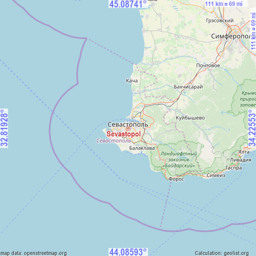
| Upper-left | 45.08741°, | 32.81928° |
| Center: | 44.58883°, | 33.5224° |
| Lower-right: | 44.08593°, | 34.22553° |
| Map W x H: | 111.4×111.4 km | = 69.2×69.2mi |
| max Lat: | 52.18903° ⇑98% North |
| Sevastopol: | 44.58883° |
| min Lat: | ⇓2% South 44.39214° |
| min Long | Sevastopol | max Long |
| 22.20555° | 33.5224° | 40.13222° |
| W 52%⇐ | ⇒48% E |
Elevation
Elevation of Sevastopol is 72 m = 236 ft, and this is 83.8 m = 275 ft below average elevation for this country.
| Max E: |
886 m = 2907 ft | 71.1% |
| Avg. | 155.8 m = 511 ft | |
| Sevastopol | 72 m = 236 ft | |
Min E: |
-3 m = -10 ft | 28.9% |
See also: Sevastopol elevation on elevation.city.
Geographical zone
Sevastopol is located in North temperate zone (between Tropic of Cancer and the Arctic Circle). Distance of this Northern Tropic circle is 2351.9 km =1461.4 mi to South.| Distance of | km | miles | from Sevastopol |
|---|---|---|---|
| North Pole | 5049.2 | 3137.4 | to North |
| Arctic Circle | 2443.4 | 1518.3 | to North |
| Tropic Cancer | 2351.9 | 1461.4 | to South |
| Equator | 4957.8 | 3080.6 | to South |


Nearby cities:
15 places around Sevastopol: (largest is in red/bold)
• Balaklava
10.6 km =6.6 mi,  144°
144°
• Fruktovoye
11.9 km =7.4 mi,  31°
31°
• Inkerman
7.5 km =4.7 mi,  68°
68°
• Khmel’nitskoye
11.5 km =7.1 mi,  115°
115°
• Orlovka
16.3 km =10.1 mi,  16°
16°
• Pervomayskoye
9.4 km =5.8 mi,  126°
126°
• Polyushko
17.8 km =11.1 mi, 17°
• Rodnoye
17.6 km =10.9 mi,  102°
102°
• Sakharnaya Golovka
9.6 km =6 mi,  93°
93°
• Shturmovoye
8.3 km =5.2 mi,  106°
106°
• Suvorovo
18.2 km =11.3 mi, 27°
• Ternovka
18.1 km =11.2 mi, 93°
• Verkhnesadovoye
18.1 km =11.2 mi,  51°
51°
• Vishnyovoye
17.3 km =10.7 mi, 22°
• Zolotaya Balka (1 otd.)
8.5 km =5.3 mi, 137°
In other languages:
- In France: Sébastopol
- In German: Sewastopol
- In Italian: Sebastopoli
- In Russian: Севастополь
- In Chinese: 塞瓦斯托波爾
Sources, notices
• [Note1] Compared only with cities in Ukraine existing in our database
• [Src1] Map data: © OpenStreetMap contributors (CC-BY-SA)
• [Src2] Other city data from geonames.org with taken over terms of usage.
• [Src3] Geographical zone / Annual Mean Temperature by Robert A. Rohde @ Wikipedia
