Rodnoye geodata
Rodnoye (Sevastopol City) is a populated place; located in Ukraine in Europe/Simferopol (GMT+3) time zone. With population of 702 people, there are 1531 cities with bigger population in this country. Compared to other cities in Ukraine, 98.4% of cities are located further ↑North; 56.3% of cities are located further ←West and 79.6% of cities have lower elevation than Rodnoye. Note1
Administrative division(s):
- Level 1: Sevastopol City
- Level 2: Balaklava District
- Level 3: Ternovskiy munitsipal'niy okrug


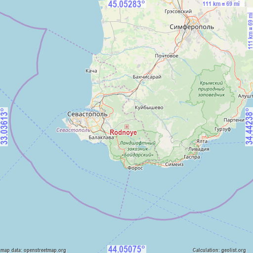
Rodnoye GPS coordinates[2]
44° 33' 14.22" North, 33° 44' 21.3" East
| Map corner | latitude | longitude |
|---|---|---|
| Upper-left | 45.05283°, | 33.03613° |
| Center: | 44.55395°, | 33.73925° |
| Lower-right: | 44.05075°, | 34.44238° |
| Map W x H: | 111.4×111.4 km | = 69.2×69.2mi |
| max Lat: | 52.18903° ⇑98.4% North |
| Rodnoye: | 44.55395° |
| min Lat: | ⇓1.6% South 44.39214° |
| min Long | Rodnoye | max Long |
| 22.20555° | 33.73925° | 40.13222° |
| W 56.3%⇐ | ⇒43.7% E |
Elevation
Elevation of Rodnoye is 244 m = 801 ft, and this is 88.2 m = 289 ft above average elevation for this country.
| Max E: |
886 m = 2907 ft | 20.4% |
| Rodnoye | 244 m 801 ft | |
| Avg. | 155.8 m = 511 ft | |
Min E: |
-3 m = -10 ft | 79.6% |
See also: Ukraine elevation on elevation.city.
Geographical zone
Rodnoye is located in North temperate zone (between Tropic of Cancer and the Arctic Circle). Distance of this Northern Tropic circle is 2348 km =1459 mi to South.| Distance of | km | miles | from Rodnoye |
|---|---|---|---|
| North Pole | 5053.1 | 3139.8 | to North |
| Arctic Circle | 2447.2 | 1520.6 | to North |
| Tropic Cancer | 2348 | 1459 | to South |
| Equator | 4953.9 | 3078.2 | to South |


Nearby cities:
15 places around Rodnoye: (largest is in red/bold)
• Balaklava
12.1 km =7.5 mi,  246°
246°
• Goncharnoye
10.3 km =6.4 mi,  197°
197°
• Inkerman
12.2 km =7.6 mi,  303°
303°
• Khmel’nitskoye
6.8 km =4.2 mi,  261°
261°
• Kholmovka
11.7 km =7.3 mi,  5°
5°
• Krasnyi Mak
10.4 km =6.5 mi,  18°
18°
• Orlinoye
12.3 km =7.6 mi,  166°
166°
• Peredovoye
8.7 km =5.4 mi,  124°
124°
• Pervomayskoye
9.7 km =6 mi, 260°
• Sakharnaya Golovka
8.2 km =5.1 mi,  293°
293°
• Shirokoye
8.6 km =5.3 mi,  164°
164°
• Shturmovoye
9.4 km =5.8 mi,  279°
279°
• Ternovka
3 km =1.9 mi, 18°
• Tylovoye
12.5 km =7.8 mi,  182°
182°
• Zolotaya Balka (1 otd.)
11.8 km =7.3 mi, 258°
Sources, notices
• [Note1] Compared only with cities in Ukraine existing in our database
• [Src1] Map data: © OpenStreetMap contributors (CC-BY-SA)
• [Src2] Other city data from geonames.org with taken over terms of usage.
• [Src3] Geographical zone / Annual Mean Temperature by Robert A. Rohde @ Wikipedia
