Nevyts’ke geodata
Nevyts’ke (Transcarpathia) is a populated place; located in Ukraine in Europe/Uzhgorod (GMT+3) time zone. With population of 1,032 people, there are 1360 cities with bigger population in this country. Compared to other cities in Ukraine, 59.8% of cities are located further ↓South; 99.7% of cities are located further →East and 51.1% of cities have higher elevation than Nevyts’ke. Note1


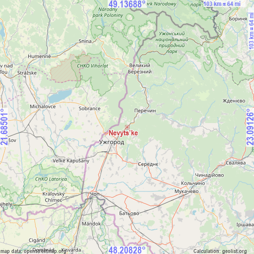
Nevyts’ke GPS coordinates[2]
48° 40' 28.992" North, 22° 23' 17.268" East
| Map corner | latitude | longitude |
|---|---|---|
| Upper-left | 49.13688°, | 21.68501° |
| Center: | 48.67472°, | 22.38813° |
| Lower-right: | 48.20828°, | 23.09126° |
| Map W x H: | 103.3×103.2 km | = 64.2×64.1mi |
| max Lat: | 52.18903° ⇑40.2% North |
| Nevyts’ke: | 48.67472° |
| min Lat: | ⇓59.8% South 44.39214° |
| min Long | Nevyts’ke | max Long |
| 22.20555° | 22.38813° | 40.13222° |
| W 0.3%⇐ | ⇒99.7% E |
Elevation
Elevation of Nevyts’ke is 130 m = 427 ft, and this is 25.8 m = 85 ft below average elevation for this country.
| Max E: |
886 m = 2907 ft | 51.1% |
| Avg. | 155.8 m = 511 ft | |
| Nevyts’ke | 130 m = 427 ft | |
Min E: |
-3 m = -10 ft | 48.9% |
See also: Ukraine elevation on elevation.city.
Geographical zone
Nevyts’ke is located in North temperate zone (between Tropic of Cancer and the Arctic Circle). Distance of this North polar circle is 1989.1 km =1236 mi to North.| Distance of | km | miles | from Nevyts’ke |
|---|---|---|---|
| North Pole | 4594.9 | 2855.1 | to North |
| Arctic Circle | 1989.1 | 1236 | to North |
| Tropic Cancer | 2806.2 | 1743.7 | to South |
| Equator | 5412.1 | 3362.9 | to South |


Nearby cities:
15 places around Nevyts’ke: (largest is in red/bold)
• Batiovo
34.8 km =21.6 mi,  178°
178°
• Chop
30.2 km =18.8 mi,  206°
206°
• Kamianytsia
2.2 km =1.4 mi,  14°
14°
• Mukacheve
35.7 km =22.2 mi,  137°
137°
• Mynay
12.7 km =7.9 mi,  221°
221°
• Nove Davydkovo
31.1 km =19.3 mi,  146°
146°
• Onokivtsi
3.9 km =2.4 mi,  240°
240°
• Perechyn
9.7 km =6 mi,  45°
45°
• Poroshkovo
26.8 km =16.7 mi,  91°
91°
• Rakoshyno
27.7 km =17.2 mi, 146°
• Serednye
17.3 km =10.7 mi, 149°
• Storozhnytsya
13.9 km =8.6 mi, 235°
• Strabychovo
33.4 km =20.8 mi,  160°
160°
• Uzhgorod
9.1 km =5.7 mi,  225°
225°
• Velykyi Bereznyi
24.3 km =15.1 mi, 12°
Sources, notices
• [Note1] Compared only with cities in Ukraine existing in our database
• [Src1] Map data: © OpenStreetMap contributors (CC-BY-SA)
• [Src2] Other city data from geonames.org with taken over terms of usage.
• [Src3] Geographical zone / Annual Mean Temperature by Robert A. Rohde @ Wikipedia
