Perechyn geodata
Perechyn (Transcarpathia) is a seat of a second-order administrative division; located in Ukraine in Europe/Uzhgorod (GMT+3) time zone. With population of 7,000 people, there are 509 cities with bigger population in this country. Compared to other cities in Ukraine, 61.1% of cities are located further ↓South; 99.4% of cities are located further →East and 54.6% of cities have lower elevation than Perechyn. Note1


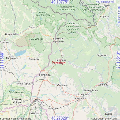
Perechyn GPS coordinates[2]
48° 44' 10.176" North, 22° 28' 55.2" East
| Map corner | latitude | longitude |
|---|---|---|
| Upper-left | 49.19775°, | 21.77888° |
| Center: | 48.73616°, | 22.482° |
| Lower-right: | 48.27029°, | 23.18513° |
| Map W x H: | 103.1×103.1 km | = 64.1×64.1mi |
| max Lat: | 52.18903° ⇑38.9% North |
| Perechyn: | 48.73616° |
| min Lat: | ⇓61.1% South 44.39214° |
| min Long | Perechyn | max Long |
| 22.20555° | 22.482° | 40.13222° |
| W 0.6%⇐ | ⇒99.4% E |
Elevation
Elevation of Perechyn is 151 m = 495 ft, and this is 4.8 m = 16 ft below average elevation for this country.
| Max E: |
886 m = 2907 ft | 45.4% |
| Avg. | 155.8 m = 511 ft | |
| Perechyn | 151 m = 495 ft | |
Min E: |
-3 m = -10 ft | 54.6% |
See also: Ukraine elevation on elevation.city.
Geographical zone
Perechyn is located in North temperate zone (between Tropic of Cancer and the Arctic Circle). Distance of this North polar circle is 1982.2 km =1231.7 mi to North.| Distance of | km | miles | from Perechyn |
|---|---|---|---|
| North Pole | 4588.1 | 2850.9 | to North |
| Arctic Circle | 1982.2 | 1231.7 | to North |
| Tropic Cancer | 2813 | 1747.9 | to South |
| Equator | 5419 | 3367.2 | to South |


Nearby cities:
15 places around Perechyn: (largest is in red/bold)
• Chop
39.5 km =24.5 mi,  211°
211°
• Chynadiyovo
37.7 km =23.4 mi,  138°
138°
• Kamianytsia
7.9 km =4.9 mi,  233°
233°
• Mukacheve
37.3 km =23.2 mi,  152°
152°
• Mynay
22.4 km =13.9 mi,  222°
222°
• Nevyts’ke
9.7 km =6 mi, 225°
• Nove Davydkovo
34.4 km =21.4 mi,  162°
162°
• Onokivtsi
13.5 km =8.4 mi, 229°
• Poroshkovo
21.3 km =13.2 mi,  110°
110°
• Rakoshyno
31.1 km =19.3 mi, 164°
• Serednye
21.8 km =13.5 mi,  175°
175°
• Storozhnytsya
23.5 km =14.6 mi, 231°
• Strabychovo
38.5 km =23.9 mi,  173°
173°
• Uzhgorod
18.8 km =11.7 mi, 225°
• Velykyi Bereznyi
17 km =10.6 mi,  354°
354°
Sources, notices
• [Note1] Compared only with cities in Ukraine existing in our database
• [Src1] Map data: © OpenStreetMap contributors (CC-BY-SA)
• [Src2] Other city data from geonames.org with taken over terms of usage.
• [Src3] Geographical zone / Annual Mean Temperature by Robert A. Rohde @ Wikipedia
