Muzhiyevo geodata
Muzhiyevo (Transcarpathia) is a populated place; located in Ukraine in Europe/Uzhgorod (GMT+3) time zone. With population of 2,086 people, there are 1092 cities with bigger population in this country. Compared to other cities in Ukraine, 52.6% of cities are located further ↑North; 99.1% of cities are located further →East and 55.7% of cities have higher elevation than Muzhiyevo. Note1


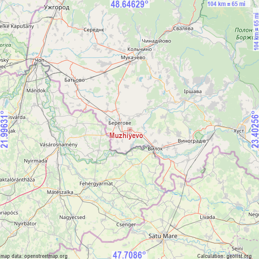
Muzhiyevo GPS coordinates[2]
48° 10' 46.524" North, 22° 41' 57.948" East
| Map corner | latitude | longitude |
|---|---|---|
| Upper-left | 48.64629°, | 21.99631° |
| Center: | 48.17959°, | 22.69943° |
| Lower-right: | 47.7086°, | 23.40256° |
| Map W x H: | 104.3×104.3 km | = 64.8×64.8mi |
| max Lat: | 52.18903° ⇑52.6% North |
| Muzhiyevo: | 48.17959° |
| min Lat: | ⇓47.4% South 44.39214° |
| min Long | Muzhiyevo | max Long |
| 22.20555° | 22.69943° | 40.13222° |
| W 0.9%⇐ | ⇒99.1% E |
Elevation
Elevation of Muzhiyevo is 118 m = 387 ft, and this is 37.8 m = 124 ft below average elevation for this country.
| Max E: |
886 m = 2907 ft | 55.7% |
| Avg. | 155.8 m = 511 ft | |
| Muzhiyevo | 118 m = 387 ft | |
Min E: |
-3 m = -10 ft | 44.3% |
See also: Ukraine elevation on elevation.city.
Geographical zone
Muzhiyevo is located in North temperate zone (between Tropic of Cancer and the Arctic Circle). Distance of this North polar circle is 2044.1 km =1270.1 mi to North.| Distance of | km | miles | from Muzhiyevo |
|---|---|---|---|
| North Pole | 4650 | 2889.4 | to North |
| Arctic Circle | 2044.1 | 1270.1 | to North |
| Tropic Cancer | 2751.1 | 1709.5 | to South |
| Equator | 5357.1 | 3328.7 | to South |


Nearby cities:
15 places around Muzhiyevo: (largest is in red/bold)
• Batiovo
30 km =18.6 mi,  312°
312°
• Berehove
5 km =3.1 mi, 305°
• Bobovo
18.9 km =11.7 mi,  129°
129°
• Chetfalva
9.2 km =5.7 mi, 130°
• Irshava
29.4 km =18.3 mi,  58°
58°
• Koson’
19.9 km =12.4 mi,  294°
294°
• Mukacheve
28.9 km =18 mi,  2°
2°
• Nove Davydkovo
29.7 km =18.5 mi,  348°
348°
• Oleshnyk
19.5 km =12.1 mi,  95°
95°
• Pidvynohradiv
20.7 km =12.9 mi, 102°
• Strabychovo
26.3 km =16.3 mi,  333°
333°
• Vary
6.5 km =4 mi,  171°
171°
• Velyki Berehy
6.8 km =4.2 mi,  30°
30°
• Vylok
13 km =8.1 mi, 127°
• Vynohradiv
24.6 km =15.3 mi, 99°
Sources, notices
• [Note1] Compared only with cities in Ukraine existing in our database
• [Src1] Map data: © OpenStreetMap contributors (CC-BY-SA)
• [Src2] Other city data from geonames.org with taken over terms of usage.
• [Src3] Geographical zone / Annual Mean Temperature by Robert A. Rohde @ Wikipedia
