Krinichnoye geodata
Krinichnoye (Republic of Crimea) is a seat of a third-order administrative division; located in Ukraine in Europe/Simferopol (GMT+3) time zone. With population of 898 people, there are 1434 cities with bigger population in this country. Compared to other cities in Ukraine, 90.7% of cities are located further ↑North; 74.9% of cities are located further ←West and 77.1% of cities have lower elevation than Krinichnoye. Note1
Administrative division(s):
- Level 1: Republic of Crimea
- Level 2: Belogorskiy rayon
- Level 3: Krinichnenskoye sel'skoye poselenye


Krinichnoye GPS coordinates[2]
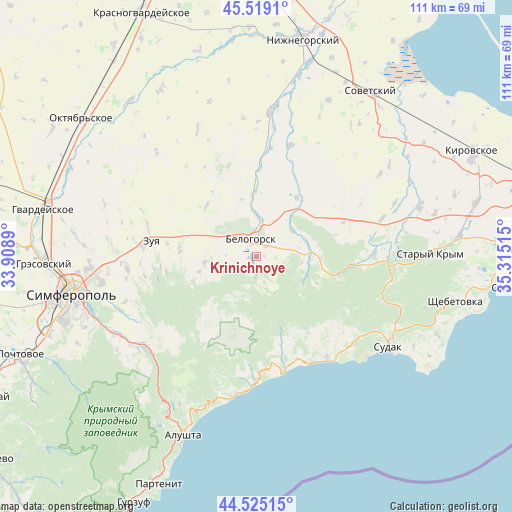
45° 1' 27.408" North, 34° 36' 43.272" East
| Map corner | latitude | longitude |
|---|---|---|
| Upper-left | 45.5191°, | 33.9089° |
| Center: | 45.02428°, | 34.61202° |
| Lower-right: | 44.52515°, | 35.31515° |
| Map W x H: | 110.5×110.5 km | = 68.7×68.7mi |
| max Lat: | 52.18903° ⇑90.7% North |
| Krinichnoye: | 45.02428° |
| min Lat: | ⇓9.3% South 44.39214° |
| min Long | Krinichnoye | max Long |
| 22.20555° | 34.61202° | 40.13222° |
| W 74.9%⇐ | ⇒25.1% E |
Elevation
Elevation of Krinichnoye is 234 m = 768 ft, and this is 78.2 m = 257 ft above average elevation for this country.
| Max E: |
886 m = 2907 ft | 22.9% |
| Krinichnoye | 234 m 768 ft | |
| Avg. | 155.8 m = 511 ft | |
Min E: |
-3 m = -10 ft | 77.1% |
See also: Ukraine elevation on elevation.city.
Geographical zone
Krinichnoye is located in North temperate zone (between Tropic of Cancer and the Arctic Circle). Distance of this North polar circle is 2394.9 km =1488.1 mi to North.| Distance of | km | miles | from Krinichnoye |
|---|---|---|---|
| North Pole | 5000.8 | 3107.4 | to North |
| Arctic Circle | 2394.9 | 1488.1 | to North |
| Tropic Cancer | 2400.3 | 1491.5 | to South |
| Equator | 5006.2 | 3110.7 | to South |


Nearby cities:
15 places around Krinichnoye: (largest is in red/bold)
• Aleksandrovka
6.6 km =4.1 mi,  271°
271°
• Aromatnoye
16.8 km =10.4 mi, 274°
• Balki
12.8 km =8 mi,  254°
254°
• Belaya Skala
7.7 km =4.8 mi,  5°
5°
• Bilohirsk
3.5 km =2.2 mi,  346°
346°
• Bogatoye
12.2 km =7.6 mi,  87°
87°
• Chernopolye
3.1 km =1.9 mi,  44°
44°
• Golovanovka
5.7 km =3.5 mi,  164°
164°
• Lechebnoye
11.2 km =7 mi,  73°
73°
• Michurinskoye
9.3 km =5.8 mi,  53°
53°
• Novoklyonovo
9.4 km =5.8 mi,  257°
257°
• Rusakovka
15.4 km =9.6 mi,  315°
315°
• Vasilyevka
15.5 km =9.6 mi,  34°
34°
• Vishennoye
13.5 km =8.4 mi, 354°
• Zelenogorskoye
11.4 km =7.1 mi, 263°
Sources, notices
• [Note1] Compared only with cities in Ukraine existing in our database
• [Src1] Map data: © OpenStreetMap contributors (CC-BY-SA)
• [Src2] Other city data from geonames.org with taken over terms of usage.
• [Src3] Geographical zone / Annual Mean Temperature by Robert A. Rohde @ Wikipedia
