Lanchyn geodata
Lanchyn (Ivano-Frankivsk) is a populated place; located in Ukraine in Europe/Kiev (GMT+3) time zone. With population of 7,718 people, there are 464 cities with bigger population in this country. Compared to other cities in Ukraine, 56.8% of cities are located further ↓South; 87.5% of cities are located further →East and 95.7% of cities have lower elevation than Lanchyn. Note1


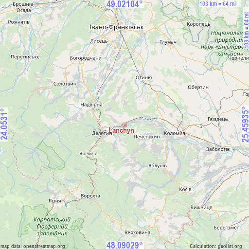
Lanchyn GPS coordinates[2]
48° 33' 28.116" North, 24° 45' 22.392" East
| Map corner | latitude | longitude |
|---|---|---|
| Upper-left | 49.02104°, | 24.0531° |
| Center: | 48.55781°, | 24.75622° |
| Lower-right: | 48.09029°, | 25.45935° |
| Map W x H: | 103.5×103.5 km | = 64.3×64.3mi |
| max Lat: | 52.18903° ⇑43.2% North |
| Lanchyn: | 48.55781° |
| min Lat: | ⇓56.8% South 44.39214° |
| min Long | Lanchyn | max Long |
| 22.20555° | 24.75622° | 40.13222° |
| W 12.5%⇐ | ⇒87.5% E |
Elevation
Elevation of Lanchyn is 379 m = 1243 ft, and this is 223.2 m = 732 ft above average elevation for this country.
| Max E: |
886 m = 2907 ft | 4.3% |
| Lanchyn | 379 m 1243 ft | |
| Avg. | 155.8 m = 511 ft | |
Min E: |
-3 m = -10 ft | 95.7% |
See also: Ukraine elevation on elevation.city.
Geographical zone
Lanchyn is located in North temperate zone (between Tropic of Cancer and the Arctic Circle). Distance of this North polar circle is 2002.1 km =1244 mi to North.| Distance of | km | miles | from Lanchyn |
|---|---|---|---|
| North Pole | 4607.9 | 2863.2 | to North |
| Arctic Circle | 2002.1 | 1244 | to North |
| Tropic Cancer | 2793.2 | 1735.6 | to South |
| Equator | 5399.1 | 3354.8 | to South |


Nearby cities:
15 places around Lanchyn: (largest is in red/bold)
• Bili Oslavy
8.8 km =5.5 mi,  207°
207°
• Bytkiv
22.2 km =13.8 mi,  291°
291°
• Delyatyn
10.4 km =6.5 mi,  248°
248°
• Hvizd
20.7 km =12.9 mi,  313°
313°
• Kolomyia
20.8 km =12.9 mi,  98°
98°
• Krasna
4.6 km =2.9 mi,  295°
295°
• Nadvirna
16.2 km =10.1 mi, 301°
• Otyniya
21.4 km =13.3 mi,  21°
21°
• Pechenizhyn
11.2 km =7 mi,  114°
114°
• Pniv
18 km =11.2 mi, 291°
• Sadzhavka
2.5 km =1.6 mi,  68°
68°
• Velykyy Klyuchiv
17 km =10.6 mi,  124°
124°
• Yabluniv
21.7 km =13.5 mi,  141°
141°
• Yaremche
19 km =11.8 mi,  231°
231°
• Zarichchya
8.9 km =5.5 mi,  242°
242°
Sources, notices
• [Note1] Compared only with cities in Ukraine existing in our database
• [Src1] Map data: © OpenStreetMap contributors (CC-BY-SA)
• [Src2] Other city data from geonames.org with taken over terms of usage.
• [Src3] Geographical zone / Annual Mean Temperature by Robert A. Rohde @ Wikipedia
