Yabluniv geodata
Yabluniv (Ivano-Frankivsk) is a populated place; located in Ukraine in Europe/Kiev (GMT+3) time zone. With population of 1,798 people, there are 1152 cities with bigger population in this country. Compared to other cities in Ukraine, 52.8% of cities are located further ↓South; 86.3% of cities are located further →East and 94.4% of cities have lower elevation than Yabluniv. Note1


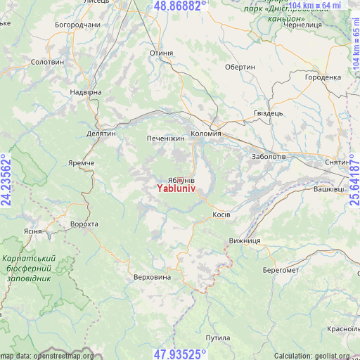
Yabluniv GPS coordinates[2]
48° 24' 15.048" North, 24° 56' 19.464" East
| Map corner | latitude | longitude |
|---|---|---|
| Upper-left | 48.86882°, | 24.23562° |
| Center: | 48.40418°, | 24.93874° |
| Lower-right: | 47.93525°, | 25.64187° |
| Map W x H: | 103.8×103.8 km | = 64.5×64.5mi |
| max Lat: | 52.18903° ⇑47.2% North |
| Yabluniv: | 48.40418° |
| min Lat: | ⇓52.8% South 44.39214° |
| min Long | Yabluniv | max Long |
| 22.20555° | 24.93874° | 40.13222° |
| W 13.7%⇐ | ⇒86.3% E |
Elevation
Elevation of Yabluniv is 351 m = 1152 ft, and this is 195.2 m = 640 ft above average elevation for this country.
| Max E: |
886 m = 2907 ft | 5.6% |
| Yabluniv | 351 m 1152 ft | |
| Avg. | 155.8 m = 511 ft | |
Min E: |
-3 m = -10 ft | 94.4% |
See also: Ukraine elevation on elevation.city.
Geographical zone
Yabluniv is located in North temperate zone (between Tropic of Cancer and the Arctic Circle). Distance of this North polar circle is 2019.1 km =1254.6 mi to North.| Distance of | km | miles | from Yabluniv |
|---|---|---|---|
| North Pole | 4625 | 2873.8 | to North |
| Arctic Circle | 2019.1 | 1254.6 | to North |
| Tropic Cancer | 2776.1 | 1725 | to South |
| Equator | 5382 | 3344.2 | to South |


Nearby cities:
15 places around Yabluniv: (largest is in red/bold)
• Bili Oslavy
19.8 km =12.3 mi,  297°
297°
• Khymchyn
15.6 km =9.7 mi,  97°
97°
• Kolomyia
15.9 km =9.9 mi,  27°
27°
• Kosiv
15.6 km =9.7 mi,  131°
131°
• Kosmach
12 km =7.5 mi,  226°
226°
• Kuty
24 km =14.9 mi, 132°
• Lanchyn
21.7 km =13.5 mi,  321°
321°
• Pechenizhyn
12.8 km =8 mi,  345°
345°
• Rechka
13.8 km =8.6 mi,  181°
181°
• Rozhniv
21.6 km =13.4 mi, 101°
• Sadzhavka
21.1 km =13.1 mi,  328°
328°
• Sheshory
8.7 km =5.4 mi,  157°
157°
• Stari Kuty
22.8 km =14.2 mi, 130°
• Velykyy Klyuchiv
7.4 km =4.6 mi,  4°
4°
• Zarichchya
25.1 km =15.6 mi, 301°
Sources, notices
• [Note1] Compared only with cities in Ukraine existing in our database
• [Src1] Map data: © OpenStreetMap contributors (CC-BY-SA)
• [Src2] Other city data from geonames.org with taken over terms of usage.
• [Src3] Geographical zone / Annual Mean Temperature by Robert A. Rohde @ Wikipedia
