Dymer geodata
Dymer (Kyiv) is a populated place; located in Ukraine in Europe/Kiev (GMT+3) time zone. With population of 5,653 people, there are 592 cities with bigger population in this country. Compared to other cities in Ukraine, 94.1% of cities are located further ↓South; 66.1% of cities are located further →East and 58.5% of cities have higher elevation than Dymer. Note1


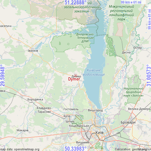
Dymer GPS coordinates[2]
50° 47' 11.292" North, 30° 18' 9.36" East
| Map corner | latitude | longitude |
|---|---|---|
| Upper-left | 51.22888°, | 29.59948° |
| Center: | 50.78647°, | 30.3026° |
| Lower-right: | 50.33983°, | 31.00573° |
| Map W x H: | 98.9×98.9 km | = 61.5×61.5mi |
| max Lat: | 52.18903° ⇑5.9% North |
| Dymer: | 50.78647° |
| min Lat: | ⇓94.1% South 44.39214° |
| min Long | Dymer | max Long |
| 22.20555° | 30.3026° | 40.13222° |
| W 33.9%⇐ | ⇒66.1% E |
Elevation
Elevation of Dymer is 111 m = 364 ft, and this is 44.8 m = 147 ft below average elevation for this country.
| Max E: |
886 m = 2907 ft | 58.5% |
| Avg. | 155.8 m = 511 ft | |
| Dymer | 111 m = 364 ft | |
Min E: |
-3 m = -10 ft | 41.5% |
See also: Ukraine elevation on elevation.city.
Geographical zone
Dymer is located in North temperate zone (between Tropic of Cancer and the Arctic Circle). Distance of this North polar circle is 1754.2 km =1090 mi to North.| Distance of | km | miles | from Dymer |
|---|---|---|---|
| North Pole | 4360.1 | 2709.2 | to North |
| Arctic Circle | 1754.2 | 1090 | to North |
| Tropic Cancer | 3041 | 1889.6 | to South |
| Equator | 5646.9 | 3508.8 | to South |


Nearby cities:
15 places around Dymer: (largest is in red/bold)
• Borodianka
31.2 km =19.4 mi,  239°
239°
• Bucha
27.8 km =17.3 mi,  193°
193°
• Horenka
25.6 km =15.9 mi,  175°
175°
• Hostomel
24.4 km =15.2 mi, 186°
• Irpin
29.7 km =18.5 mi, 187°
• Ivankiv
33.3 km =20.7 mi,  300°
300°
• Katyuzhanka
11.8 km =7.3 mi,  280°
280°
• Khotyanivka
28.3 km =17.6 mi,  138°
138°
• Klavdiyevo-Tarasove
30.4 km =18.9 mi,  222°
222°
• Kotsyubyns’ke
33.2 km =20.6 mi, 176°
• Liutizh
13.1 km =8.1 mi,  150°
150°
• Novi Petrivtsi
20.3 km =12.6 mi, 150°
• Pukhivka
35.2 km =21.9 mi,  123°
123°
• Vorzel’
28.9 km =18 mi,  201°
201°
• Vyshhorod
26 km =16.2 mi, 149°
Sources, notices
• [Note1] Compared only with cities in Ukraine existing in our database
• [Src1] Map data: © OpenStreetMap contributors (CC-BY-SA)
• [Src2] Other city data from geonames.org with taken over terms of usage.
• [Src3] Geographical zone / Annual Mean Temperature by Robert A. Rohde @ Wikipedia
